

No. 1 General Report on Survey of Katherine–Darwin Region, 1946
Land Research Surveys
2010(1) 1 - 177
Published: 2010
Abstract
In the immediate aftermath of World War II, there was renewed concern that Australia’s north was underpopulated and undeveloped and that there was little accurate or reliable information to support planning. The Katherine–Darwin region was the first priority for systematic surveys of natural resources in northern Australia. The survey covered nearly 70,000 km2 of highly variable lands in the northwest of the Northern Territory, enclosing the East Alligator and Daly River catchments.
Map coverage of the area was limited in quality and coverage. Aerial photography was available, but variable in age, quality, scale and method. The first field party had to overcome these difficulties and, to do so, developed a new approach to inventory and description of the landscape that identified composite mapping units to which they gave the name “land systems”.
Broad patterns of geology, topography, soils and vegetation were outlined on aerial photographs as a basis for planning traverses and the location of sampling sites. Following field studies, the land systems were described and verified with information from traverses, 306 sample sites and other sources and their boundaries transferred to maps. This approach permitted determination of broad “potentialities” for agricultural and pastoral development of each land system without detailed investigation of its whole area.
In total, 19 land systems were mapped with descriptions of their location, accessibility, extent, topography, geology and geomorphology, soils, vegetation, climate and water supply, present land use, and their agricultural and pastoral prospects. Additional chapters in the report discuss past and present production and future industry and regional developments.
The survey team made a number of recommendations that contributed, inter alia, to the establishment of research stations and, later, to a more detailed survey of the Tipperary land system and another of the Adelaide–Alligator area (see No. 13 and No. 25).
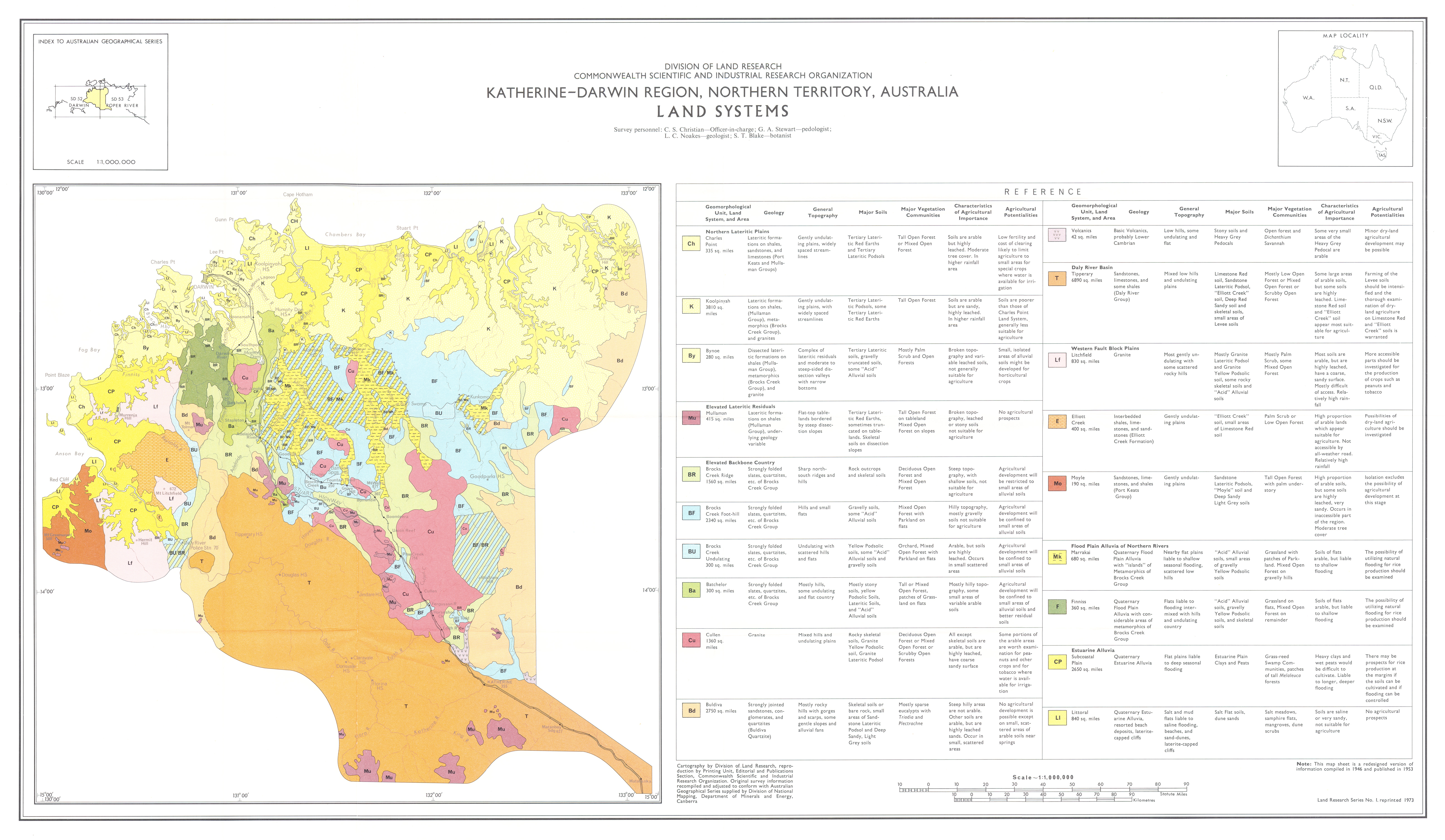
Map 1 — Land Systems of the Katherine–Darwin region, Northern Territory 1946. Scale 8 miles to 1 inch. Issued with CSIRO Land Research Series No. 1, 1953. Reprinted 1973 at scale 1:1,000,000.
Map 2 — Reconnaissance Geological Map of the Katherine–Darwin region, Northern Territory December 1948. Scale 8 miles to 1 inch. Issued with CSIRO Land Research Series No. 1, 1953.
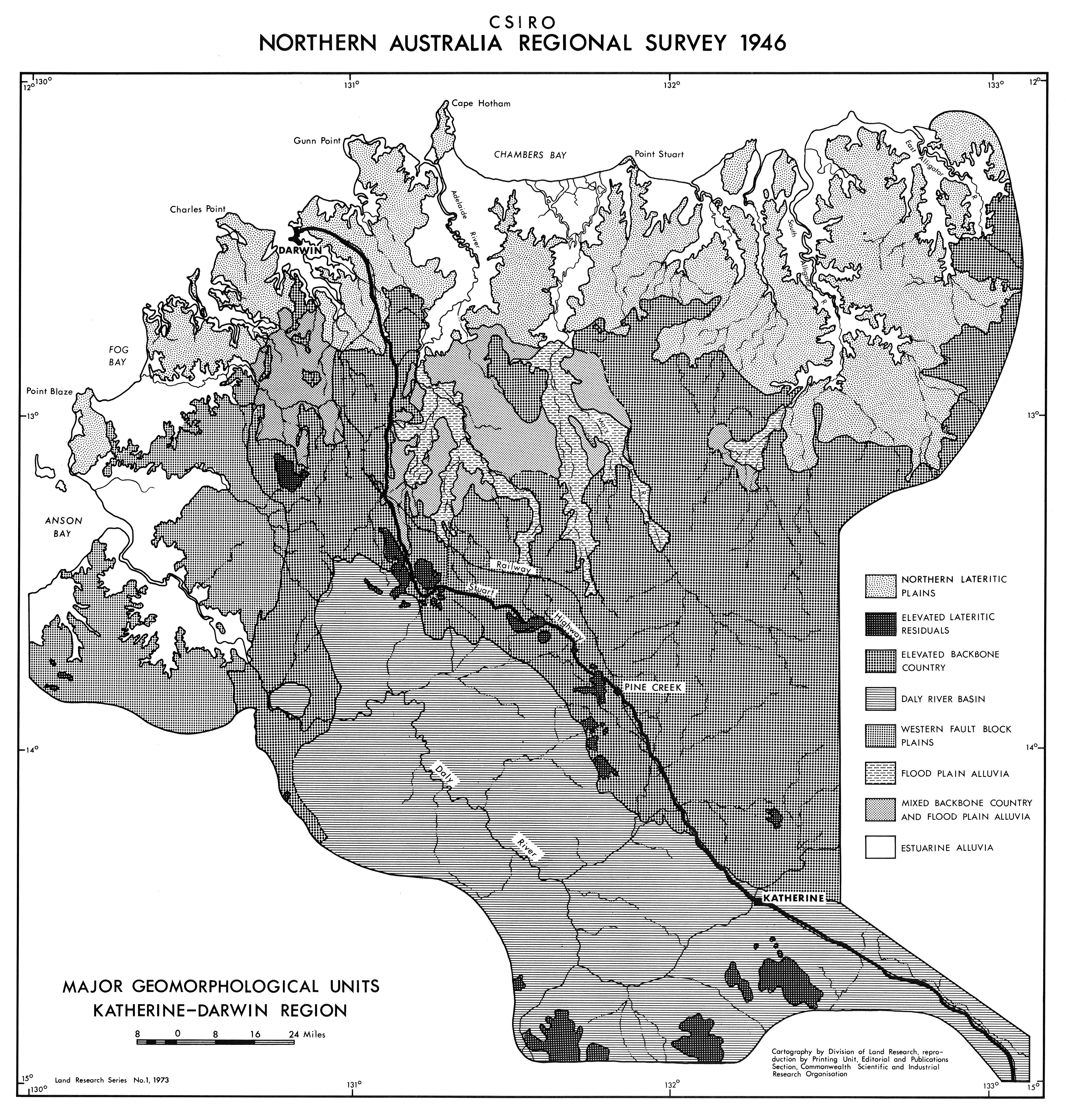
Map 3 — Major Geomorphological Units of the Katherine–Darwin region compiled by CS Christian and GA Stewart. Scale 24 miles to 1 inch (black and white). Issued with Land Research Series No. 1, 1953. Reprinted in 1973.
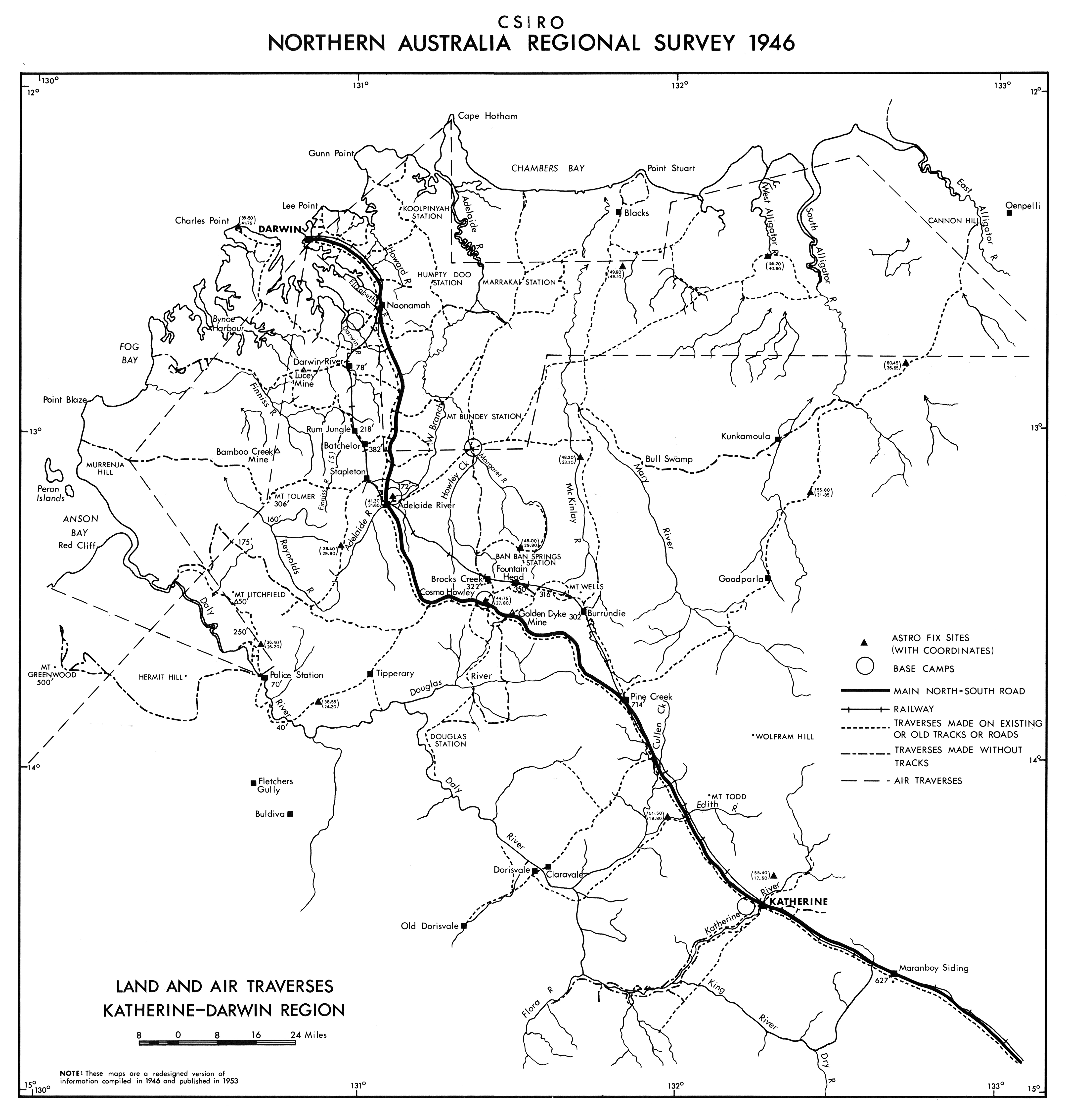
Map 4 — Land and Air Traverses of the Katherine–Darwin region. Scale 24 miles to 1 inch (black and white). Issued with Land Research Series No. 1, 1953. Reprinted in 1973.
https://doi.org/10.1071/LRS01
© CSIRO 2010