

No. 2 Survey of the Townsville–Bowen Region, North Queensland, 1950
Land Research Surveys
2010(1) 1 - 95
Published: 2010
Abstract
CSIRO’s survey of the Townsville–Bowen area was undertaken at the request of a Committee considering a proposal to develop the lower Burdekin River valley, including damming of the Burdekin River. The survey covered a wider region that included the area proposed for development.
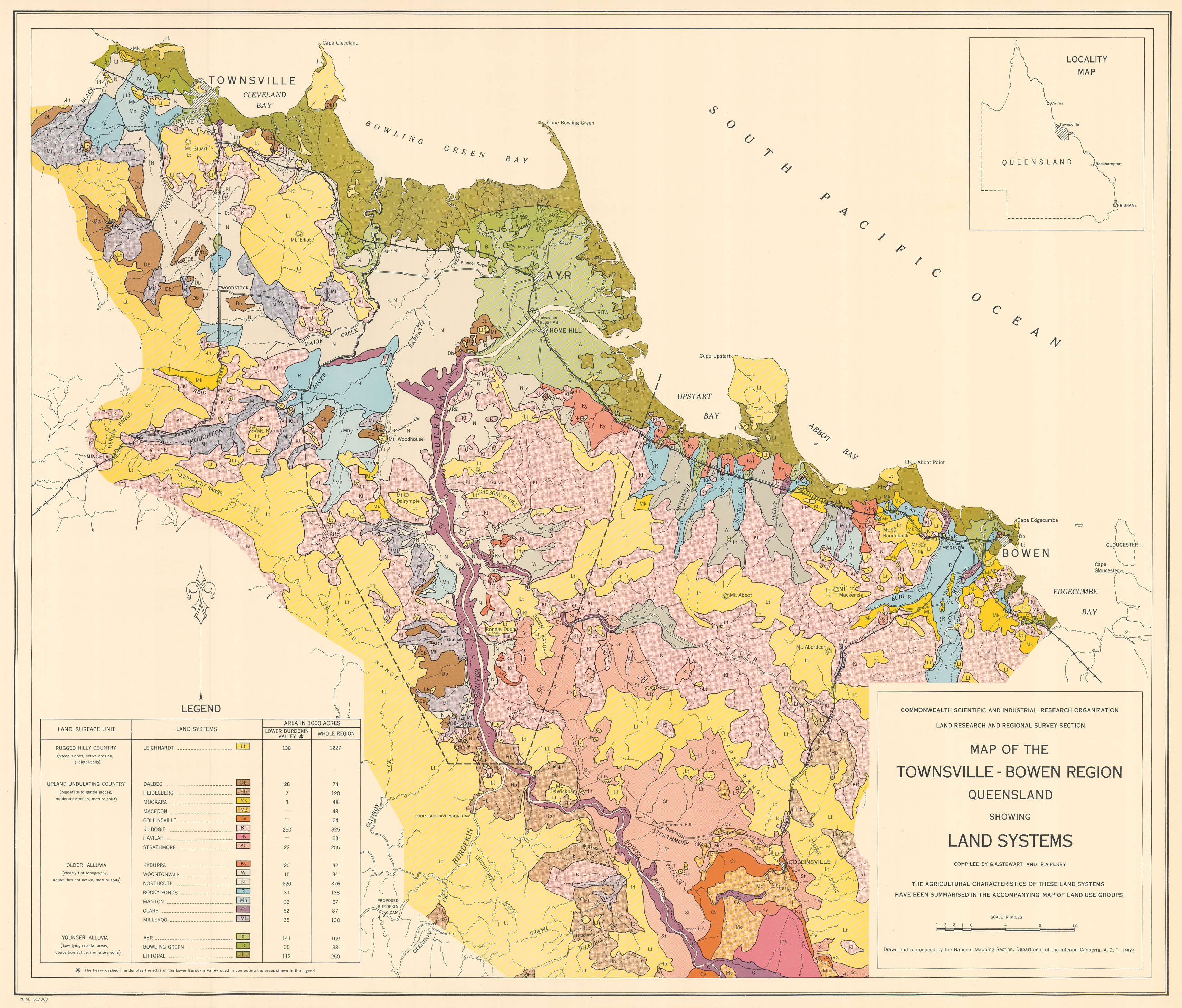
This survey covered an area of 15,550 km2 and recognised 19 land systems ranging in area from about 97 km2 to 4,965 km2. A general description of the landscape and climate is given for the individual land systems together with a summary of their geology and geomorphology. Each land system has between two and seven land units, except one system representing levee country too complex to differentiate.
In addition to the chapter describing the land systems, the report has six individual explanatory chapters:- Climate — describes general climatic characteristics, and factors significant for rain-fed and irrigated agriculture
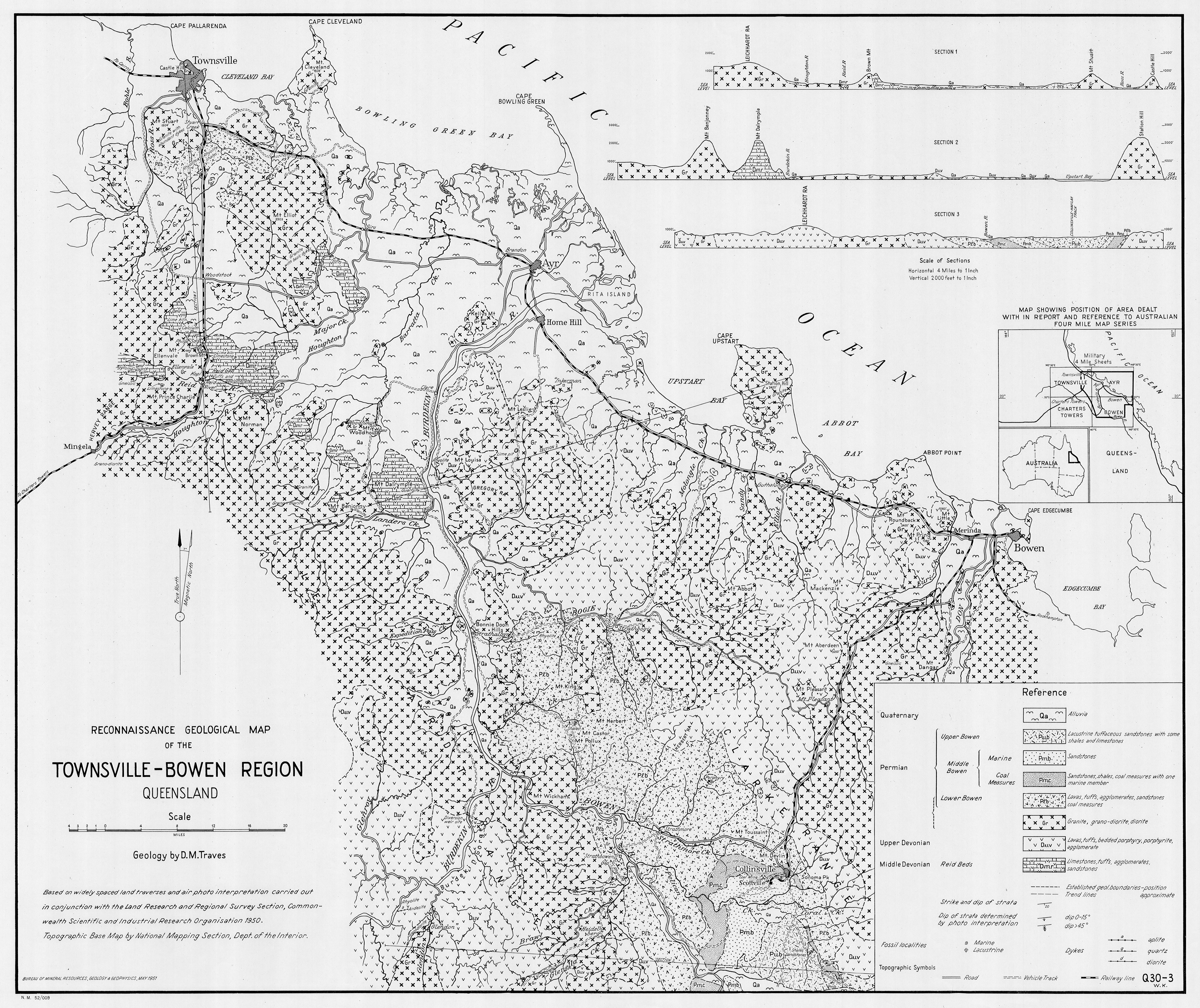
- Geology — briefly outlines the main rock types and where they occur
- Geomorphology — recognises three major physiographic provinces and describes four land surface units (landscapes) distinguished on the basis of their origin and physical characteristics
- Soils and their Agricultural Characteristics — describes 37 soil groups in relation to their topography and parent material with a general description of depth (thickness) colour, texture and other attributes of typical horizons and the characteristics that support or constrain their use
- Vegetation — describes the general location and extent of 21 main vegetation communities in relation to topography, drainage and soils, outlines relationships between vegetation and the physical environment, and describes the main tree and grass communities
- Land Use Groups and their Potentialities — outlines current use and its relation to climate and discusses the relation between groupings of land systems and their development with or without irrigation
Map 1 — Land Systems of the Townsville–Bowen region, Queensland compiled by GA Stewart and RA Perry. Scale 4 miles to 1 inch. CSIRO Land Research Series No. 2, 1952.
Map 2 — Land Use Groups of the Townsville–Bowen region, Queensland. Scale 4 miles to 1 inch. CSIRO Land Research Series No. 2, 1952.
Map 3 — Reconnaissance Geological Map of the Townsville–Bowen region, Queensland. Geology by DM Traves, BMR 1951. Scale 4 miles to 1 inch (black and white). CSIRO Land Research Series No. 2, 1952.
Editor’s Note: Damming of the Burdekin River was subsequently completed in 1987 with 43,000 ha now irrigated.
https://doi.org/10.1071/LRS02
© CSIRO 2010