

No. 4 The Lands and Pastoral Resources of the North Kimberley Area, W.A.
Land Research Surveys
2010(1) 1 - 116
Published: 2010
Abstract
The North Kimberley region survey was undertaken in 1953–54. The area was then amongst the most remote and least known of the continent, requiring complementary work by the Western Australian government that included pack horse reconnaissance for routes for road construction. CSIRO’s contribution included aerial photo interpretation for a preliminary land classification that identified 14 map units, followed by a field survey — largely following new tracks opened by the State Government party. An agricultural economist accompanied the CSIRO landform, soil and vegetation scientists.
The area surveyed covered nearly 88,000 km2 of generally rugged terrain extending from sea level to ~855 m dominated by skeletal or sandy soils with eucalyptus woodlands or forests and poor quality pastures. Nine land systems were identified, ranging in area from ~415 km2 to ~41,440 km2 and each with four or five land units.
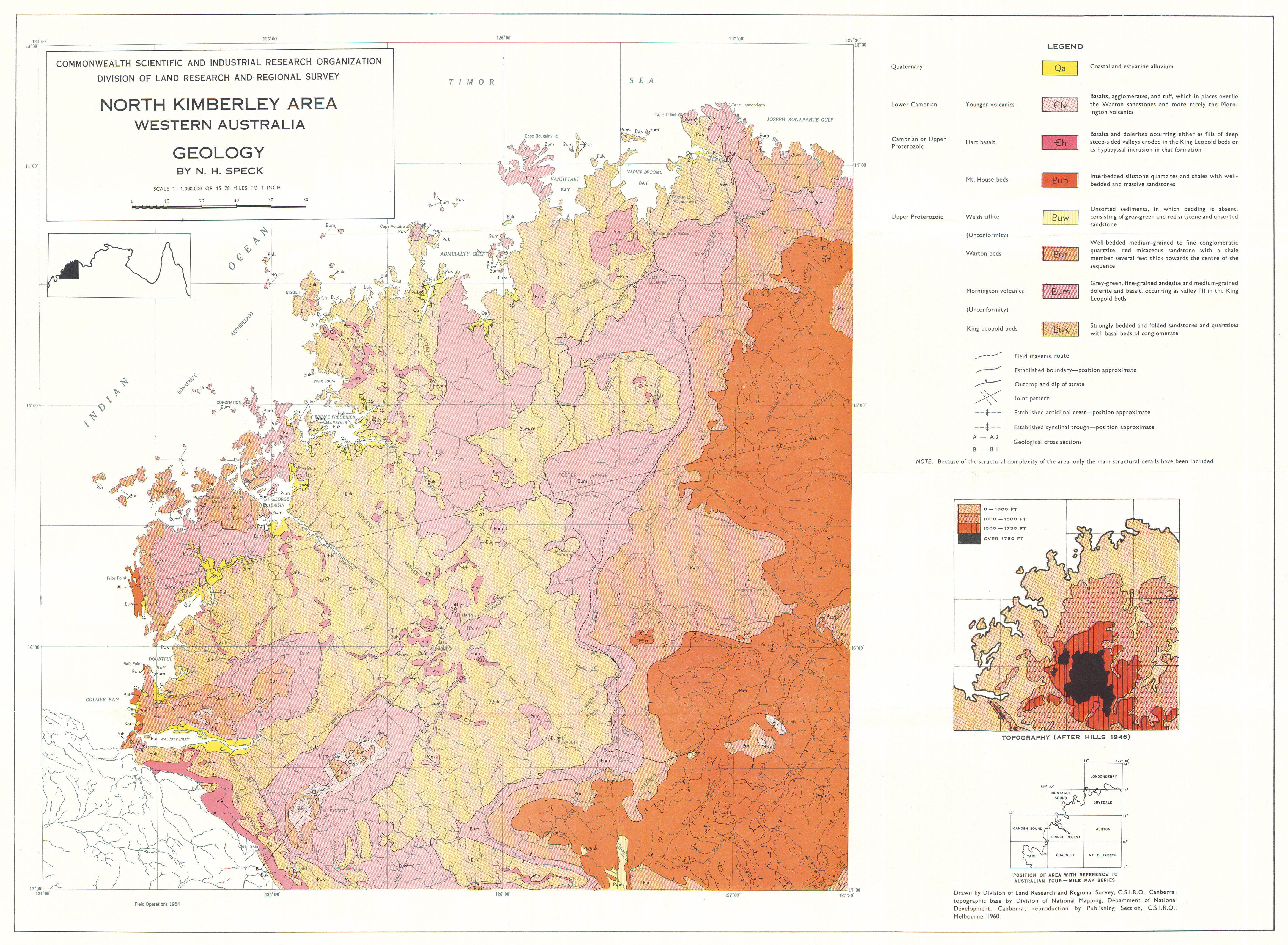
The report describes them in terms of their relative area, topography, soils, vegetation and pastures. General descriptions of location, drainage, geology and geomorphology of the land systems and distribution of the land units with illustrative block diagrams are provided.
Individual chapters describe:
- Climate — general characteristics and their relation to plant growth
- Geology — stratigraphic units and their relation to land systems
- Geomorphology — physiography and drainage and characteristics of six geomorphological
- Soils — major physical and agricultural characteristics of 12 soil groups
- Vegetation — main features of 76 associations
- Pastures — composition of 15 types in four groups
- Present and Potential Land Use – relation to climate and water availability and the carrying capacity of pastures; supplementary chapters discuss economic aspects of the cattle industry and beef production
Map 1 — Land Systems of the North Kimberley area, Western Australia by NH Speck. Scale 1:1,000,000. CSIRO Land Research Series No. 4, 1960.
Map 2 — Geology of the North Kimberley area, Western Australia by NH Speck. Scale 1:1,000,000. CSIRO Land Research Series No. 4, 1960.
Editor's Note: The area has several rivers, notably the Durack, Drysdale, King Edward, Prince Regent, Charnley and Isdell which flow between northeast and west to the strongly indented and often spectacular coast. Tributaries of the Fitzroy River flow south.
https://doi.org/10.1071/LRS04
© CSIRO 2010