

No. 26 Lands of the Mitchell–Normanby Area, Queensland
Land Research Surveys
2010(1) 1 - 117
Published: 2010
Abstract
The Mitchell–Normanby area survey was conducted at the request of the Queensland government to meet the need for improved knowledge of the country to underpin rational development. The survey covered about 142,500 km2 in six physical regions including the lower two-thirds of Cape York Peninsula, Cooktown and, to the west, the main aboriginal community of Kowanyama.
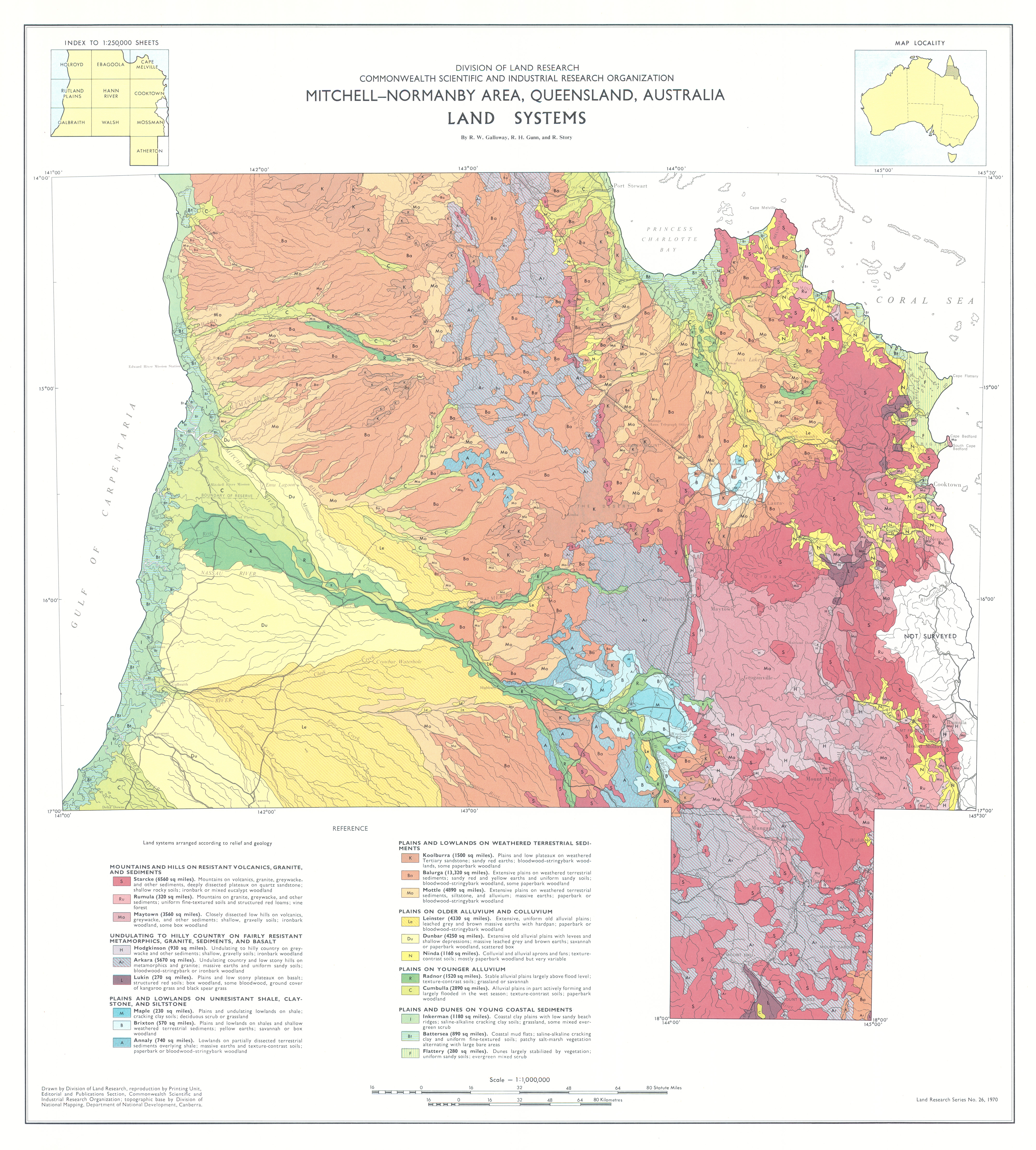
The report describes the 20 land systems ranging from about 600 km2 to 34,500 km2, each with between three and six land units except for one with only a single unit, and the relative area and distribution, landforms, soils and vegetation of 77 land units with their position in the landscape shown on block diagrams.
The report has five individual disciplinary chapters:
- Climate — describes the general climatic characteristics
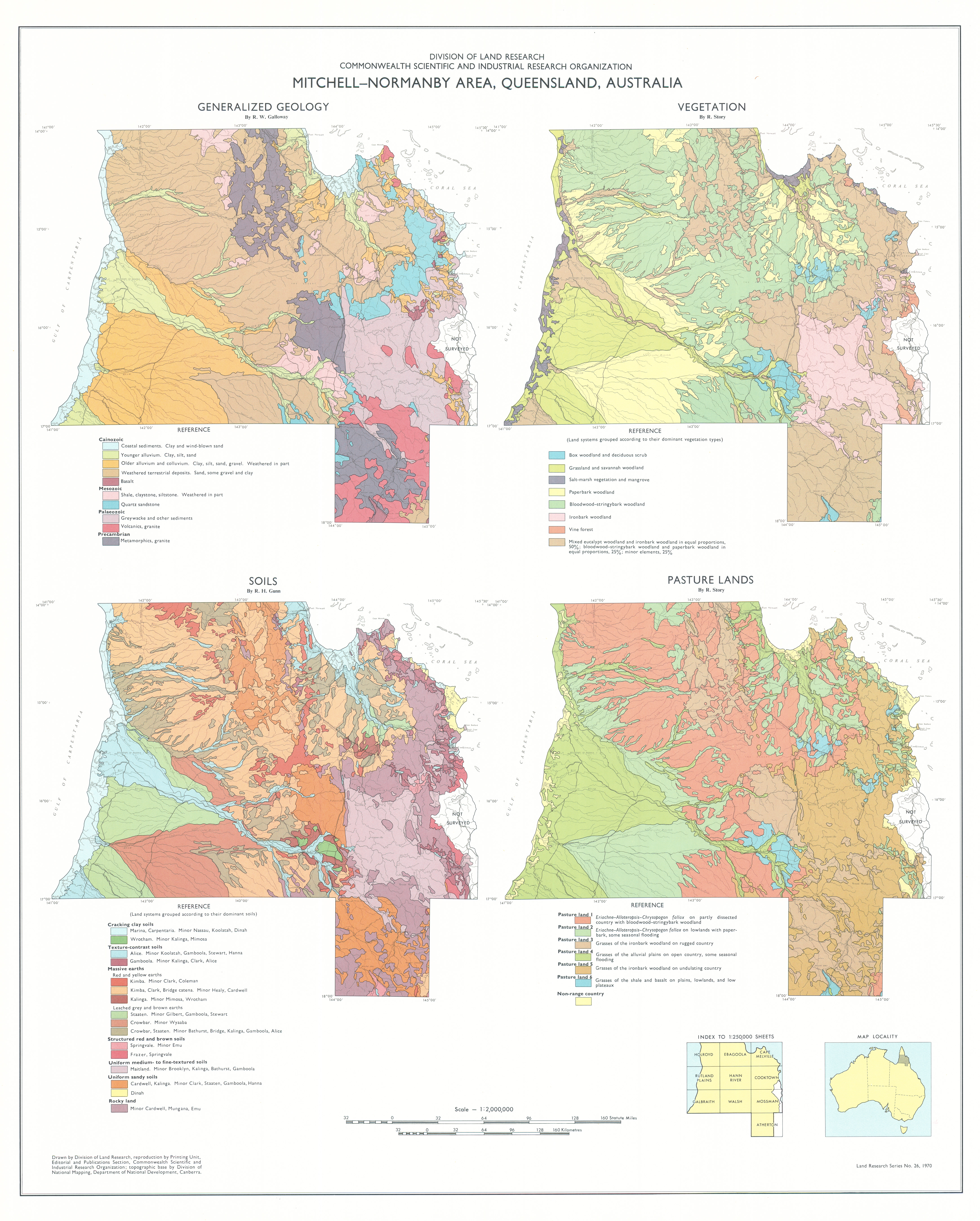
- Geology and Relief — describes landscape history and the relationships between landform and ten major types of rock
- Soils — identifies 37 soil families in eight major groups and describes their characteristics, origin and their distribution in a framework of land systems grouped according to geology and relief
- Vegetation — identifies two major vegetation regions and describes 16 vegetation types, their area and distribution in relation to land systems
- Land Use — describes six types of pasture lands and one of land not suitable for grazing, discusses the suitability of the eight soil groups and outlines the present situation and possible developments of the cattle, agricultural and forest industries
Map 1 — Land Systems of the Mitchell–Normanby area, Queensland, Australia by RW Galloway, RH Gunn and R Story. Scale 1:1,000,000. CSIRO Land Research Series No. 26, 1970.
Map 2 — Generalized Geology, Vegetation, Soils and Pasture Lands of the Mitchell–Normanby area, Queensland, Australia. Four maps on sheet, each scale 1:2,000,000: Generalized Geology by RW Galloway; Vegetation by R Story; Soils by RH Gunn; Pasture Lands by R Story. CSIRO Land Research Series No 26, 1970.
The maps were digitised by the Queensland Government with permission of CSIRO. Access to the digital files can be obtained from the Queensland Department of Natural Resources and Water
Editor's Note: The survey included Cooktown (population 3642 in 2006) and the area has a number of National Parks, notably Cape Melville and Lakefield, east of the Great Dividing Range and Staaten River, Mitchell and Alice Rivers National Parks to the west. The main centre is the aboriginal community of Kowanyama (current population ~1,100).
https://doi.org/10.1071/LRS26
© CSIRO 2010