

Developing a research and practice tool to measure walkability: a demonstration project
Billie Giles-Corti A B F G , Gus Macaulay A , Nick Middleton C , Bryan Boruff B F , Fiona Bull B F , Iain Butterworth D , Hannah Badland A F , Suzanne Mavoa A F , Rebecca Roberts A F and Hayley Christian B E FA McCaughey VicHealth Centre for Community Wellbeing, School of Population and Global Health, The University of Melbourne, Level 5, 207 Bouverie Street, Carlton, Vic. 3010, Australia.
B Centre for the Built Environment and Health, School of Population Health, University of Western Australia, 35 Stirling Highway, Crawley, WA 6009, Australia.
C NJM Spatial, 11 Leon Road, Dalkeith, WA 6009, Australia.
D North West Region Victorian Department of Health, 145 Smith Street, Fitzroy, Vic. 3065, Australia.
E Telethon Kids Institute, University of Western Australia, PO Box 855, West Perth, WA 6872, Australia.
F NHMRC CRE in Healthy Liveable Communities, School of Population and Global Health, University of Melbourne, Level 5, 207 Bouverie Street, Carlton, Vic. 3010, Australia.
G Corresponding author. Email: b.giles-corti@unimelb.edu.au
Health Promotion Journal of Australia 25(3) 160-166 https://doi.org/10.1071/HE14050
Submitted: xxx xxx 2014 Accepted: xxx xxx 2014 Published:
Journal Compilation © Australian Health Promotion Association 2014
Abstract
Issue addressed: Growing evidence shows that higher-density, mixed-use, pedestrian-friendly neighbourhoods encourage active transport, including transport-related walking. Despite widespread recognition of the benefits of creating more walkable neighbourhoods, there remains a gap between the rhetoric of the need for walkability and the creation of walkable neighbourhoods. Moreover, there is little objective data to benchmark the walkability of neighbourhoods within and between Australian cities in order to monitor planning and design intervention progress and to assess built environment and urban policy interventions required to achieve increased walkability. This paper describes a demonstration project that aimed to develop, trial and validate a ‘Walkability Index Tool’ that could be used by policy makers and practitioners to assess the walkability of local areas; or by researchers to access geospatial data assessing walkability. The overall aim of the project was to develop an automated geospatial tool capable of creating walkability indices for neighbourhoods at user-specified scales.
Methods: The tool is based on open-source software architecture, within the Australian Urban Research Infrastructure Network (AURIN) framework, and incorporates key sub-component spatial measures of walkability (street connectivity, density and land use mix).
Results: Using state-based data, we demonstrated it was possible to create an automated walkability index. However, due to the lack of availability of consistent of national data measuring land use mix, at this stage it has not been possible to create a national walkability measure. The next stage of the project is to increase useability of the tool within the AURIN portal and to explore options for alternative spatial data sources that will enable the development of a valid national walkability index.
Conclusion: AURIN’s open-source Walkability Index Tool is a first step in demonstrating the potential benefit of a tool that could measure walkability across Australia. It also demonstrates the value of making accurate spatial data available for research purposes.
So what?: There remains a gap between urban policy and practice, in terms of creating walkable neighbourhoods. When fully implemented, AURIN’s walkability tool could be used to benchmark Australian cities against which planning and urban design decisions could be assessed to monitor progress towards achieving policy goals. Making cleaned data readily available for research purposes through a common portal could also save time and financial resources.
Introduction
Growing evidence shows that higher-density, mixed-use, pedestrian-friendly neighbourhoods encourage active transport, including transport-related walking.1–3 Encouraging active forms of transport, including transport-related walking, has benefits across multiple portfolios, including health, the environment, transport and community.4–6 These benefits include a reduced risk of chronic disease by encouraging physical activity, as well as benefits to air quality, traffic congestion and reduced social isolation as a result of encouraging alternative forms of transport to driving.6 The development of compact walkable environments is now actively being encouraged by multiple sectors (health, transport and land use planning), a policy direction recommended internationally by the Organisation for Economic Co-operation and Development,7 as well as in Australia in both the federal8,9 and state10–12 levels.
Despite widespread recognition of the benefits of creating more walkable neighbourhoods, there remains a gap between the rhetoric of the need for walkability and the creation of walkable neighbourhoods in practice. Fuelled by public demands for ‘affordable’ housing and property industry demands for land supply, low-density, single-use developments poorly served by public transport continue to be built on Australia’s urban fringe.13 Moreover, there is little objective evidence to benchmark the walkability of neighbourhoods within (and between) Australian cities to monitor progress towards creating more walkable areas and to assess built environment and urban policy interventions required to achieve increased walkability in new and established areas. In order to provide these benchmarks, readily available and consistent data on the walkability of Australian cities are needed.
In the past decade, there has been a rapid increase in the use of Geographic Information Systems (GIS) in built environment and physical activity research.14 In the US, Frank et al.15 pioneered the use of GIS to capture neighbourhood ‘walkability’ by combining three subcomponent spatial measures: (1) residential density, (2) street connectivity and (3) land use mix. The use and validity of this walkability index have been replicated in studies globally,16,17 including various studies across many Australian states, including South Australia,18 Western Australia (WA)19–21 and New South Wales.22
Context for this demonstration project
The population of the North West Region (NWR) of Melbourne (Victoria; see Fig. 1) is growing rapidly, with increasing concerns about the region’s walkability and liveability.23 Hence, this demonstration project was undertaken in partnership with the Department of Health (NWR) and the North West Regional Management Forum, made up of key state and local government organisations working in the region. The project was funded by the Australian Urban Research Infrastructure Network (AURIN; http://www.aurin.org.au, verified 23 October 2014), a $20 million initiative funded by the Australian Government’s Super Science scheme. AURIN aims to provide built environment and urban researchers, designers and planners with the technical infrastructure to facilitate access to a distributed network of aggregated datasets and information services, and to facilitate data being accessed, interrogated, modelled and/or simulated to assist in the improved design and management of Australian cities.

|
Within this context, this project was one of AURIN’s first demonstration projects. There were two overall aims of the study: (1) to create a tool that would assist in the translation of existing research into policy and practice; and (2) to facilitate future built environment research by overcoming problems associated with poor access to spatial data for the development of walkability indicators and a lack of available expertise in GIS to calculate walkability measures.
The specific aims of the study were to: (1) develop, trial and validate an automated open-source tool capable of creating walkability indices at user-specified scales (i.e. suburb, Australian Bureau of Statistics (ABS) Statistical Areas and user-specified road network buffers) for any Australian urban area; (2) create a flexible tool that would enable walkability to be measured using existing data available within the AURIN portal (e.g. public sector mapping agencies (PSMA), ABS and other state and Federal agencies) or to enable users to upload their own detailed data (e.g. land use, street and/or pedestrian networks); and (3) to create a tool that would allow researchers to upload geocoded addresses from survey data to create user-specified service areas (e.g. 400, 800 or 1600 m) around these addresses, and to download associated geospatial data for further interrogation. A ‘service area’ encompasses all accessible streets within a certain distance from an address (e.g. a 400-m service area for an address includes all the streets that can be reached within 400 m from that address).
Methods
Walkability index
Full details of the methods used, and decisions made, to create the walkability indices used for this project have been described elsewhere.20 Briefly, three environmental characteristics were used to construct the walkability index: (1) street connectivity; (2) residential or dwelling density (with the potential to generate either a gross density or net density value); and (3) land use mix. These built environment attributes were calculated for each participant’s ‘walkable’ service area level, defined in this study as a street network buffer that could be walked briskly within 15 min,20 or 1.6 km.24 This buffer size has been used in all our previous research20,21 and is based on the 1996 US Surgeon General Report.24 It represents approximately how far an able-bodied person could walk at a moderate to vigorous pace within 15 min, half the recommended level of daily physical activity for adults.20
Street connectivity measures the inter-connectedness of the street network as a ratio of the count of three (or more)-way intersections over the area (km2). Residential or dwelling density measures people per unit area (hectares) or density of dwellings, respectively. Both street connectivity and net dwelling density measures were based on methods used by Frank et al.15 and replicated in WA;20 however, the AURIN walkability tool also allows for the calculation of gross density. Land use mix examines the heterogeneity of land uses (of interest) within an area. The land use mix component of the walkability measure used in the AURIN system was calculated using a variant on the original formula used by Frank et al.15 and is the same as that used by Christian et al.20
Land use mix (LUM) was calculated by first extracting the area for each relevant land use (i.e. residential; retail; office; health, welfare and community; entertainment, culture and recreation) for each service area. This was used to calculate the proportion of each land use as the ratio of the area of a land use over the summed area of all land uses of interest within a service area, as follows:
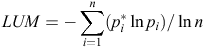
where pi is the proportion of a land use i and n is the number of land uses.
The ‘Walkability Index Tool’ has been developed to enable users to: (1) select land use information provided by AURIN; (2) upload their own land use information; or (3) construct their own land use classification using tools within the AURIN portal (see description below). The land use dataset must contain land use codes, from which a subset of land use classes can be selected providing a range of options for more experienced users to test various combinations.
Open source tool development, trial and validation
The project consisted of three phases, namely the development, trial and validation of the Walkability Index Tool. Phase 1 involved the development of an open-source web-based spatial analytical tool to examine walkability at varying scales across Australia. As noted above, the Walkability Index Tool was based on analytical tools developed by the Centre for the Built Environment and Health (CBEH) at The University of Western Australia, which were built using ArcGIS software package25 using state government datasets. ArcGIS software is not open source; however, CBEH’s tools, which were written in the Python programming language, provided a base structure for the migration of these tools to open source Java-based programs. The Walkability Index Tool in the AURIN portal was developed in the Java programming language using the open source Geotools spatial library. The tool is designed as several separate modular components (connectivity, density, land use mix, land use priority allocation), which can be configured according to the needs of the user. The code is available through the GitHub software repository (https://github.com/gusmacaulay/walkability-core, verified 23 October 2014).
Phase 2 trialled the Walkability Index Tool using national data for WA and Victoria. The national datasets (Table 1) were used within the AURIN portal to create walkability indices in Perth (WA) and Melbourne (Victoria).

|
Phase 3 validated the open source Walkability Index Tool. This was done opportunistically using WA data. We compared the ArcGIS-based tools created by the CBEH for the RESIDE study20 with the AURIN Walkability Index Tool within the AURIN portal. The ArcGIS-based tools were applied to WA data, whereas the AURIN Walkability Index Tool was applied to national datasets to test the ability of the AURIN tool to replicate the RESIDE walkability measures using national data. The results were compared for the three walkability subcomponents (i.e. land use mix, density and street connectivity) and the composite Walkability Index using data from a subset of RESIDE participants (n = 561).
Both versions of the Walkability Index Tool (i.e. the ArcGIS CBEH RESIDE version and the AURIN open source version) were used to create service areas within 1600 m of each RESIDE study participant. Notably, the service areas differed slightly depending on which tool was used. This was mostly due to the inability to replicate the ArcGIS service area function (proprietary software) as an open source tool. The approach used in the Neighbourhood Generator component of the AURIN portal tool was based on a ‘sausage buffer’, acknowledged as a valid and appropriate approach in health research of this nature.26 Correlations between the variables produced using the ArcGIS CBEH Walkability Index method and the AURIN open source Walkability Index Tool were examined using SPSS (version 21.0.0.0).
Results
Table 2 shows the correlation between the Walkability Indices, as well as the subcomponents created by CBEH using ArcGIS and measures created using the AURIN open source Walkability Index Tool. There was a high correlation (P < 0.000) between the measures of connectivity and density (r ≥ 0.80). However, the correlation between the CBEH’s ‘land use’ variables (derived using the state-based Valuer General’s data) and the land use variables derived using national data (based on ABS MESH block data), although significant (P < 0.000), were considered unacceptably low (r < 0.30). When combined into composite indices of walkability, indices calculated using CBEH’s state-level data and those calculated using AURIN’s national-level data were moderately correlated (r = 0.7–0.8; P < 0.000). Nevertheless, given the poor validity of the national land use mix data, at this stage it is not recommended that the AURIN Walkability Index Tool be used with national data until an appropriate source of data for the land use mix calculation is identified.

|
Because of the poor quality of the national land use variable, walkability in Victoria was assessed using Victorian data (rather than using national data). For interest, Fig. 2 maps the walkability of our study area, the north-west region of Melbourne, for ABS Statistical Area 1 (referred to hereafter as SA1). SA1 is the second smallest statistical unit of the ABS with, on average, ~400 people, with densities of ≥3 dwellings per hectare.

|
In Fig. 2, walkability is presented as ‘deciles of walkability’, with the more walkable areas indicated in shades of green (most walkable = darkest green). Low walkable areas are shown in shades of orange (least walkable = red). Fig. 2 shows that walkability varies across the north-west Melbourne region. Most of the outer growth areas generally exhibit lower walkability, whereas inner Melbourne is generally shown in shades of green, indicating much higher walkability. However, even in outer Melbourne there are some areas with various shades of green reflecting the fact that, in these areas, there is reasonable connectivity, mixed use and higher densities.
Discussion
AURIN’s open-source tool was developed to assist in translating research on walkability into policy and practice, and to facilitate future research. Although there is considerable discussion about the benefits of creating more pedestrian-friendly environments, there is often a gap between policy and implementation. For example, a recent WA study found that a state government policy designed to create more walkable pedestrian-friendly environments was only 50% implemented.27 Having access to a user-friendly tool that can assess an area’s walkability may assist both policy makers and advocates to evaluate policy as well as advocate for better walkability outcomes.
This demonstration project aimed to explore whether it was possible to create a tool that could be used by policy makers and practitioners to benchmark neighbourhood walkability within and between Australian cities, against which policy objectives and built environment interventions could be measured and monitored over time. Moreover, for researchers, our aim was to develop a tool that could facilitate national- and state-level built environment research by providing access to cleaned spatial data to be used either within the AURIN portal or to enable walkability measures to be downloaded for analysis with other datasets (e.g. travel behaviour or health data).
A key feature of the AURIN Walkability Index Tool is its flexibility: it can be used to assess the overall walkability of cities, suburbs or neighbourhoods, or even to compare the walkability of neighbourhoods surrounding key destinations (e.g. schools, train stations or aged care facilities). However, the tool is also designed to facilitate research by enabling other spatial measures to be added (e.g. access to public transport, retail floor area, block size) or different algorithms for developing subcomponents of the walkability index (e.g. the land use mix variable) to be tested. In so doing, we have created a tool that facilitates access to data and is sufficiently flexible to facilitate further research in this area.
Because this project was a demonstration project, we have identified several limitations, particularly related to the data that could be used to create walkability indices. First, at this stage it is not possible to create a scientifically valid national walkability index. Despite several attempts, a comparable land use mix variable could not be derived using national data (e.g. PSMA and Mesh Block data, or a combination of the two). This appears to be because the available datasets are insufficiently precise to measure the variety of land uses in an area (e.g. ABS Mesh Block data). Hence, in this project it was necessary to use state-based data (in this case the Valuer General’s dataset for Victoria). The Valuer General’s dataset is very useful for mapping land use because it is dynamic and is regularly updated in response to changing land features and land sales. However, variations in land use codes applied by different states may restrict the ability to accurately compare results across the country. A national source of land use data that is consistent across states and sufficiently precise (i.e. cadastre-level land use) is needed to advance the development of national walkability measures. Therefore, sourcing such data or modifying the coding of future national datasets warrants further exploration. Identifying an appropriate source of land use data is a priority in the next stage of this project.
Second, the tool is a measure of neighbourhood walkability and its use must be restricted to urban environments in cities and regional towns. For rural areas, measuring and mapping walkability is likely to provide skewed results, especially when calculating deciles of walkability for the composite measures (which is a relative measure). In Fig. 1, we restricted SA1s to those with densities of at least three houses per hectare. However, this may have limitations and another approach may have been preferable to exclude large, low-density SA1s. This requires further exploration.
Third, the establishment of the AURIN portal is a new way of working with urban spatial data and has been built from the ground up. At this stage, the AURIN portal and the Walkability Index Tool are not ‘user friendly,’ requiring expertise to navigate. Hence, a second phase of the project has been funded by AURIN to improve the useability of the tool. This will involve workshops with user groups to obtain their feedback and working with AURIN’s technical team to incorporate these ideas to build a more user-friendly portal and the Walkability Index Tool.
Fourth, the walkability index we have developed includes only the variables frequently used in walkability tools in the US and Australia (i.e. land use mix, density and street connectivity). This may not include all the variables that may contribute to an area’s walkability (e.g. access to public transport, block length, topography). However, AURIN did not aim to fund new research. Rather, its aim was to fund demonstration projects that could show the value of making data available for urban policy making and research using tools already shown to be effective in previous research. Further research could explore the value of adding these additional variables into the walkability indices.
Finally, a major challenge for comparing cities across Australia is the need for consistent and reliable national data. In some cases, the required spatial data are not available. If national datasets are available made up of state data, the data are often collected inconsistently across the various jurisdictions. This is an impediment to undertaking national research. Moreover, in some cases there are restrictions on the use of data. These restrictions hamper urban research, and increasing access to data through portals such as AURIN is to be encouraged. This problem represents an even bigger problem when undertaking international research, a challenge that is beyond the scope of this paper but has been identified through major international studies focused on understanding the built environment.17
Conclusions
The development of the AURIN open source Walkability Index Tool is a first step in demonstrating the potential benefit of a tool that could measure walkability across Australia. For example, it could be used to benchmark Australian cities to influence planning and policy decisions at the local, state and national government levels and against which progress could be assessed. It also demonstrates the value of making accurate spatial data available for research purposes. This will save time and financial resources, allowing researchers to focus on advancing measurement of neighbourhood attributes. We have shown that AURIN’s open source Walkability Index Tool can be used effectively using data sourced from states. The next major research challenge is to upscale the Tool to measure the walkability of all Australian capital cities, allowing comparison within and between cities. However, beyond research, the policy challenge is to transcend the rhetoric of the benefits of ‘walkability’ and to use evidence to influence decisions that create walkable neighbourhoods that determine the health and well being of Australians, as well as the environmental sustainability and economic resilience of Australia.
Acknowledgements
This project was funded by the Australian Urban Research Infrastructure Network (AURIN) and this funding is gratefully acknowledged, together with the technical and leadership AURIN teams members, particularly Professor Bob Stimson, Associate Professor Chris Pettit, Dr Martin Tomko and Dr William Voorsluys for their assistance with this project. Our industry partners for the Place Health and Liveability Program, the Department of Health NW Region and the NW Regional Management Forum (RMF) are acknowledged. In particular, the assistance of the former Chair of the NW RMF, Mr Jim Betts, in facilitating access to the data used in this project is gratefully acknowledged. SM is supported by Community Indicators Victoria, which is funded by VicHealth; BGC is supported by a National Health and Medicine Research Council (NHMRC) Principal Research Fellowship (#1004900); and HC is supported by an NHMRC–National Heart Foundation Early Career Fellowship (#1036350). Particular thanks to the open source software providers through which the AURIN Walkability Index Tool was developed (GeoTools, OpenLayer, JTS, GeoJSN). Finally, this project would not have been possible without the support of the GIS team at the University of Western Australia Centre for the Built Environment and Health, who assisted with cleaning and preparing data for this project (Sharyn Hickey and Bridget Beasley). Moreover, they, together with other members of the RESIDE study team, have contributed to intellectual capital that underpins this project, and this expertise and contribution is gratefully acknowledged. Data for this project were obtained from a range of sources, including Landgate in Western Australia, the Valuer General’s Office in Victoria, the Australian Bureau of Statistics and the PSMA.
References
[1] Transportation Research Board (TRB). Does the built environment influence physical activity? Examining the evidence. Washington, DC: TRB; 2005.[2] National Institute for Health and Clinical Excellence (NICE). Promoting or creating built or natural environments that encourage and support physical activity. London: NICE; 2008.
[3] Ewing R, Cervero R (2010) Travel and the built environment. A meta-analysis. J Am Plann Assoc 76, 265–94.
| Travel and the built environment. A meta-analysis.Crossref | GoogleScholarGoogle Scholar |
[4] Rissel CE (2009) Active travel: a climate change mitigation strategy with co-benefits for health. N S W Public Health Bull 20, 10–13.
| Active travel: a climate change mitigation strategy with co-benefits for health.Crossref | GoogleScholarGoogle Scholar | 19261210PubMed |
[5] Woodcock J, Edwards P, Tonne C, Armstrong BG, Ashiru O, Banister D, et al (2009) Public health benefits of strategies to reduce greenhouse-gas emissions: urban land transport. Lancet 374, 1930–43.
| Public health benefits of strategies to reduce greenhouse-gas emissions: urban land transport.Crossref | GoogleScholarGoogle Scholar | 19942277PubMed |
[6] Giles-Corti B, Foster S, Shilton T, Falconer R (2010) The co-benefits for health of investing in active transportation. N S W Public Health Bull 21, 122–7.
| The co-benefits for health of investing in active transportation.Crossref | GoogleScholarGoogle Scholar | 20637168PubMed |
[7] OECD. International transport forum 2011: pedestrian survey, urban space and health: summary. OECD Publishing; 2012.
[8] Department of Infrastructure and Transport. Our cities, our future. A national urban policy for a productive, sustainable and liveable future. Canberra: Department of Infrastructure and Transport; 2011.
[9] Department of Infrastructure and Transport. Walking, riding and access to public transport. Canberra: Commonwealth of Australia; 2012.
[10] State of Victoria. Plan Melbourne: metropolitan planning strategy. Melbourne: Victorian Government; 2014.
[11] Western Australian Planning Commission, Department for Planning and Infrastructure. Liveable neighbourhoods: a Western Australian Government sustainable cities initiative. Perth: Western Australian Planning Commission; 2009.
[12] NSW Planning and Infrastructure. Community guide: draft metropolitan strategy for Sydney to 2031. Sydney: NSW Planning and Infrastructure; 2014.
[13] Lowe M, Boulange C, Giles-Corti B (2014) Urban design and health: progress to date and future challenges. Health Promot J Austr 25, 14–18.
| Urban design and health: progress to date and future challenges.Crossref | GoogleScholarGoogle Scholar | 24739774PubMed |
[14] Sallis JF (2009) Measuring physical activity environments: a brief history. Am J Prev Med 36, S86–92.
| Measuring physical activity environments: a brief history.Crossref | GoogleScholarGoogle Scholar | 19285214PubMed |
[15] Frank LD, Schmid TL, Sallis JF, Chapman J, Saelens BE (2005) Linking objectively measured physical activity with objectively measured urban form: findings from SMARTRAQ. Am J Prev Med 28, 117–25.
| Linking objectively measured physical activity with objectively measured urban form: findings from SMARTRAQ.Crossref | GoogleScholarGoogle Scholar | 15694519PubMed |
[16] Badland HM, Schofield GM, Witten K, Schluter PJ, Mavoa S, Kearns RA, et al (2009) Understanding the Relationship between Activity and Neighbourhoods (URBAN) study: research design and methodology. BMC Public Health 9, 224
| Understanding the Relationship between Activity and Neighbourhoods (URBAN) study: research design and methodology.Crossref | GoogleScholarGoogle Scholar | 19589175PubMed |
[17] Kerr J, Sallis JF, Owen N, De Bourdeaudhuij I, Cerin E, Sugiyama T, et al (2013) Advancing science and policy through a coordinated international study of physical activity and built environments: IPEN audit methods. J Phys Act Health 10, 581–601.
[18] Owen N, Cerin E, Leslie E, duToit L, Coffee N, Frank LD, et al (2007) Neighborhood walkability and the walking behavior of Australian adults. Am J Prev Med 33, 387–95.
| Neighborhood walkability and the walking behavior of Australian adults.Crossref | GoogleScholarGoogle Scholar | 17950404PubMed |
[19] Learnihan V, Van Niel KP, Giles-Corti B, Knuiman M (2011) Effect of scale on the links between walking and urban design. Geogr Res 49, 183–91.
| Effect of scale on the links between walking and urban design.Crossref | GoogleScholarGoogle Scholar |
[20] Christian HE, Bull FC, Middleton NJ, Knuiman MW, Divitini ML, Hooper P, et al (2011) How important is the land use mix measure in understanding walking behaviour? Results from the RESIDE study. Int J Behav Nutr Phys Act 8, 55
| How important is the land use mix measure in understanding walking behaviour? Results from the RESIDE study.Crossref | GoogleScholarGoogle Scholar | 21631958PubMed |
[21] Giles-Corti B, Knuiman M, Timperio A, Van Niel K, Pikora TJ, Bull FC, et al (2008) Evaluation of the implementation of a state government community design policy aimed at increasing local walking: design issues and baseline results from RESIDE, Perth Western Australia. Prev Med 46, 46–54.
| Evaluation of the implementation of a state government community design policy aimed at increasing local walking: design issues and baseline results from RESIDE, Perth Western Australia.Crossref | GoogleScholarGoogle Scholar | 17881044PubMed |
[22] Mayne DJ, Morgan GG, Willmore A, Rose N, Jalaludin B, Bambrick H, et al (2013) An objective index of walkability for research and planning in the Sydney Metropolitan Region of New South Wales, Australia: an ecological study. Int J Health Geogr 12, 61
| An objective index of walkability for research and planning in the Sydney Metropolitan Region of New South Wales, Australia: an ecological study.Crossref | GoogleScholarGoogle Scholar | 24365133PubMed |
[23] Badland H, Whitzman C, Lowe M, Davern M, Aye L, Butterworth I, et al (2014) Urban liveability: emerging lessons from Australia for exploring the potential for indicators to measure the social determinants of health. Soc Sci Med 111, 64–73.
| Urban liveability: emerging lessons from Australia for exploring the potential for indicators to measure the social determinants of health.Crossref | GoogleScholarGoogle Scholar | 24762261PubMed |
[24] US Department of Health and Human Services(USDHHS). Physical activity and health. A report of the Surgeon General. Atlanta, GA: USDHHS, Centres for Disease Control and Prevention, National Center for Chronic Disease Prevention and Health Promotion; 1996.
[25] Environmental Systems Research Institute (ESRI). Desktop 9.2–10.0. Redlands, CA: ESRI; 2006.
[26] Forsyth A, Van Riper D, Larson N, Wall M, Neumark-Sztainer D (2012) Creating a replicable, valid cross-platform buffering technique: the sausage network buffer for measuring food and physical activity built environments. Int J Health Geogr 11, 14
| Creating a replicable, valid cross-platform buffering technique: the sausage network buffer for measuring food and physical activity built environments.Crossref | GoogleScholarGoogle Scholar | 22554353PubMed |
[27] Hooper P, Giles-Corti B, Knuiman M (2014) Evaluating the implementation and active living impacts of a state government planning policy designed to create walkable neighborhoods in Perth, Western australia. Am J Health Promot 28, S5–18.
| Evaluating the implementation and active living impacts of a state government planning policy designed to create walkable neighborhoods in Perth, Western australia.Crossref | GoogleScholarGoogle Scholar | 24380466PubMed |
[28] Western Australian Land Information Authority (Landgate). Road centrelines. Midland, WA: Landgate; 2012.
[29] Western Australian Land Information Authority (Landgate). Spatial cadastre database. Midland, WA: Landgate; 2012.
[30] WA Valuer-General. Valuation system. Midland, WA: Landgate; 2012.
[31] PSMA. Transport and topography. Griffith, ACT: PSMA Australia Limited; 2012.
[32] Australian Bureau of Statistics. Australian Statistical Geography Standard (ASGS): Volume 1 – Main structure and greater capital city statistical areas. Belconnen, ACT: Australian Bureau of Statistics; 2011. Available from: http://www.abs.gov.au/AUSSTATS/abs@.nsf/Lookup/1270.0.55.001Main+Features1July%202011?OpenDocument [Verified 15 November, 2012].
[33] Victorian Valuer-General. Valuation System. Melbourne, Vic.: Valuer General Office; 2010.