

Australia’s tropical river systems: current scientific understanding and critical knowledge gaps for sustainable management
Stephen K. Hamilton A C and Peter C. Gehrke BA Kellogg Biological Station and Department of Zoology, Michigan State University, Hickory Corners, MI, USA.
B CSIRO Land and Water, 120 Meiers Road, Indooroopilly, Qld 4068, Australia.
C Corresponding author. Email: hamilton@kbs.msu.edu
Marine and Freshwater Research 56(3) 243-252 https://doi.org/10.1071/MF05063
Submitted: 13 April 2005 Accepted: 14 April 2005 Published: 3 June 2005
Abstract
Australia’s tropical river systems are poorly understood in comparison with Australia’s temperate freshwater and tropical marine systems. Tropical rivers convey ~70% of the continent’s freshwater runoff, and are increasingly being targeted for development. However, existing knowledge is inadequate to support policy for tropical regions that avoids repeating the environmental problems of water use in southern Australia. This paper summarises existing knowledge on the hydrogeomorphic drivers of tropical catchments, fluxes of sediments and nutrients, flow requirements and wetlands. Key research issues include improved quantification of available water resources, hydrological, biogeochemical and ecological linkages at systems scales, understanding and valuing ecosystem processes and services, and projecting the effects of long-term climate change. Two special considerations for tropical Australia are the location of major centres of government and research capacity outside the tropical region, and the legal title of much of tropical Australia vesting in Aboriginal communities with different cultural values for rivers. Both issues will need to be addressed if tropical research is to be effective in supporting resource management needs into the future. Systems-scale thinking is needed to identify links between system components and coastal enterprises, and to protect the environmental, social, and economic values of Australia’s tropical river systems.
Introduction
Australia’s tropical rivers, as well as the wetlands and estuaries associated with them, are nationally and internationally recognised for their ecological and cultural value. These tropical catchments harbour greater freshwater biodiversity than is found in temperate Australia (Pusey and Kennard 1996; Gehrke and Harris 2000; NLWRA 2002), and many of the rivers retain their natural flow regimes. Freshwater rivers and wetlands provide critical ecosystem services that sustain local economies, serve as focal elements of the landscape for traditional aboriginal cultures, and have become increasingly important for tourism. The flow of fresh water to the coastal zone supports estuarine ecosystems and near-shore commercial and recreational fisheries (Robins et al. 2005), and affects the productivity and diversity of the Great Barrier Reef, a World Heritage Area renowned for its biodiversity and valued for tourism (Furnas 2003). The coastal waters bordering tropical Australia are internationally important strongholds for marine biodiversity, and they have been less impacted by human activities than comparable tropical marine ecosystems elsewhere in the Indo-Pacific region (Valiela et al. 2001; Furnas 2003).
The two primary drivers for development of tropical catchments in Australia are social pressures to provide infrastructure and employment for people living in the region, and economic pressures for agricultural enterprises seeking to expand or relocate from southern Australia (Gehrke et al. 2004). The availability of fresh water constrains development over most of Australia, and thus the relatively rich freshwater resources of the tropical north have long attracted attention. National inventories suggest that ~70% of the continent’s freshwater resources are in the tropics. Low population density, poor agricultural prospects, and unreliable freshwater supplies have so far limited development and land-cover change over much of tropical Australia (Davidson 1969; NLWRA 2002). However, large-scale development of water resources to support expansion of irrigated agriculture, or to provide increased security for water supplies to metropolitan centres outside the tropics, continues to be discussed as a development alternative (e.g. Australian Tropical Rivers Group 2004). Other expansion opportunities include mining and aquaculture industries.
The increasing social, political and business interest in further developing water resources of tropical Australia raises concerns over the future sustainability of the ecosystems that depend on tropical rivers because the knowledge base to understand and avoid the potential impacts of this development is considered inadequate (Hart 2004). Water-resource development has already strongly changed certain rivers of the region (e.g. the Ord River in Western Australia and the Burdekin and Fitzroy rivers in Queensland), with negative environmental impacts that were unforeseen when this development was planned. In addition to large-scale development projects, water resources are subject to gradual deterioration under the influence of existing land and water use, the spread of invasive plant and animal species and global environmental change.
The forum on Sustainable Futures for Australia’s Tropical Rivers at Charles Darwin University in Darwin, Australia in February 2004 arose from recognition of the need to be proactive in providing the scientific knowledge that is critical to guide policy and decision-making on the use of tropical river systems and their catchments (Gehrke et al. 2004; Gehrke 2005). The objectives of the forum were to assemble and synthesise existing scientific knowledge of Australia’s tropical river systems, and to identify critical knowledge gaps requiring research. The geographic scope of the forum covered rivers, floodplains, wetlands, estuaries and near-coastal systems spanning tropical Australia. This paper, which complements the preceding contributed papers from the forum, outlines the major research areas presented at the forum, followed by an overview of the most critical knowledge gaps that must be filled to develop a sound scientific basis for the use, management and protection of Australia’s tropical river systems.
Australia’s tropical rivers
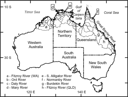
The rivers of northern Australia are generally short, arising in the coastal catchments where rainfall is higher than further inland (Fig. 1). The natural land cover of these catchments is most commonly seasonally dry forest, savanna woodland or monsoon forest, although there is also rainforest in northern Queensland catchments bordering the Coral Sea. Rangeland beef grazing and intensive row-crop agriculture have transformed upland and floodplain land cover in some catchments (Brodie and Mitchell 2005), particularly in Queensland (Furnas 2003), and seasonal burning is practiced throughout the region (Dyer et al. 2001; Russell-Smith et al. 2003).
|
Tropical Australian rivers tend to have highly seasonal flow regimes (McMahon et al. 1991), with much of their annual flow between November and May. The monsoonal climate, as well as the interannual variability in rainfall related to the El Niño Southern Oscillation and the erratic behaviour of tropical cyclones, all contribute to this variability in river-flow regimes. Consequently, the movement of water, sediments and nutrients is seasonal and often episodic (Furnas 2003; Brodie and Mitchell 2005). Catchments in the wet tropics region in north-east Queensland retain this strong seasonal pattern, but also receive significant rainfall from June through October and have relatively low interannual variability in discharge.
Seven geomorphological river types have been recognised in tropical Australia (Erskine et al. 2005), consisting of resistant bedrock channels, bedrock-confined rivers, avulsive rivers, forested meandering sand-bed rivers, island- and ridge-anabranching sand-bed rivers, co-existent mud braided and anabranching rivers and extensive wetlands and billabongs. The sequence of occurrence of these river types exerts a strong influence on the downstream succession of aquatic communities and provides an ecological template.
Rivers draining undisturbed catchments generally carry water low in nutrients (Brodie and Mitchell 2005), and aquatic primary production is nutrient-limited (Furnas 2003; Douglas et al. 2005; Townsend and Padovan 2005). Eutrophication of estuaries and coastal waters has been documented in tropical Australia and is attributed primarily to increased nutrient loading from rivers, often linked to soil erosion from agricultural activities and consequent transport of suspended particulate matter (Harris 2001; Brodie and Mitchell 2005). During floods, most rivers are very turbid, carrying fine clays in suspension that are readily transported to coastal waters (Brodie and Mitchell 2005).
As they approach the sea, many rivers flow across extensive coastal plains that have taken their present form during only the past few thousand years under the influence of Quaternary sea-level changes (White 2000; Chivas et al. 2001). During interglacial periods, sea levels sometimes reached a higher stage than at present, allowing the mangrove and estuarine zones to encroach on the coastal plains and, as a result, acid sulphate soils occur on the plains. The coastal plains commonly have a gradient in the landward direction from saline mud flats to mangroves, sedge-grass plains, freshwater wetlands and paperbark swamp forests. Seasonally inundated floodplains are integral components of the lower reaches of many of these river systems and, upon entering the coastal plains, the river channels often are not contiguous with the estuaries (Finlayson et al. 1990, 2005; Erskine et al. 2005).
Many of the estuaries of tropical Australia are in near-pristine ecological condition, in stark contrast to the relatively degraded estuaries of temperate Australia and much of south-east Asia. Along most of the coastline, estuaries are tide dominated with macrotidal regimes; tide ranges often are 7–10 m along the more westerly sections of coastline and 2–8 m in northern and eastern regions. Freshwater inflows to these estuaries are episodic and highly variable and some estuaries lack river inputs. Inorganic turbidity, generated both by river inputs and sediment resuspension through tidal action, is a key variable controlling the availability of light and nutrients for aquatic primary production in these estuaries (e.g. Burford and Rothlisberg 1999; Webster et al. 2003).
The current scientific knowledge base
Despite significant research effort to date, the geographic coverage of research has been uneven, mostly focused on the rivers draining into the Great Barrier Reef lagoon (Queensland) and on the rivers, floodplains and estuaries in the vicinity of Kakadu National Park (Alligator Rivers region, Northern Territory). Estuaries entering the Gulf of Carpentaria have been studied for their contribution to the Northern Prawn Fishery. The patchy research coverage of such a geomorphically diverse region precludes development of a robust synthesis of ecosystem processes and functions. Rather, in this section we outline the areas that have received the greatest emphasis in previous and current research efforts and are most pertinent to river system management.
Riverine fluxes of sediments and nutrients to the ocean
The riverine transport of suspended sediments and nutrients from uplands to coastal marine waters has attracted considerable scientific attention in tropical and subtropical Queensland because of concern that increasing sediment and nutrient loads largely resulting from agricultural land use are negatively impacting the Great Barrier Reef (Furnas 2003; McCulloch et al. 2003). Impacts include direct sedimentation of inorganic matter on coral reefs, as well as eutrophication caused by elevated loading of both dissolved and particulate nutrients, which in combination with increased turbidity and sedimentation can favour filamentous and fleshy algae that overgrow the corals (Furnas 2003; Wolanski et al. 2003). As a result of mounting scientific evidence for the connection between catchment land-use practices, riverine sediment and nutrient fluxes and coral reef degradation, management decisions on land are increasingly considering impacts on adjacent marine ecosystems of the Great Barrier Reef. It is clear that estuarine biogeochemical processes have a key role in moderating the transport of sediments and nutrients from rivers to coastal waters, especially during low and intermediate-sized flow events that do not completely flush the estuary (Webster et al. 2003; Ford et al. 2005). However, wetland drainage and flood protection measures in estuaries of north Queensland may compromise the ability of these ecosystems to moderate sediment and nutrient fluxes.
Less is known about the importance of riverine fluxes of sediments and nutrients to marine coastal waters across the rest of the Australian tropics, although Brodie and Mitchell (2005) summarise available studies including those on the Magela Creek and East Alligator River systems (Northern Territory) and the Ord River (Western Australia). Significant research on particulate and dissolved transport by rivers was conducted in the Alligator Rivers region, motivated originally by concerns about uranium mining in the vicinity of Kakadu National Park (Press et al. 1995). The impacts of river impoundment on sediment and nutrient discharge have been studied in the Ord River, which was dammed to supply water for irrigation (Walker 1992). Models of freshwater and nutrient flow to coastal waters have been developed to investigate scenarios of land-use change (Webster and Harris 2004).
Rivers and floodplains of the Alligator Rivers region
Throughout the 1980s, the Office of the Supervising Scientist (now the Environmental Research Institute of the Supervising Scientist – ERISS) sponsored in-depth investigations into the hydrology and sediment movement of Magela Creek, in an area where vast coastal floodplains receive overbank discharge. During and since that time, the scope of this research expanded to include a variety of ecological topics, and has generated a detailed understanding of river-floodplain linkages in this particular region (see references in Finlayson et al. 2005). Despite the relatively large effort that has been expended to study the Alligator Rivers region, current research is inadequate to track the environmental changes that are already underway in these complex riverine, floodplain, and estuarine ecosystems under the influence of multiple factors.
Environmental flows
Environmental flows refer to the allocation of water to meet the requirements of water-dependent ecosystems, including estuaries, in river systems where flow is regulated or extracted (Dyson et al. 2003). The concept of environmental flows is well researched in temperate Australia (Thoms and Sheldon 2002; Arthington and Pusey 2003), where most rivers have suffered strong impacts owing to flow alteration and reduction, but less is known about the environmental-flow requirements in the tropical river systems. This situation reflects the relatively low intensity of flow regulation in tropical rivers compared to temperate Australia, combined with the greater focus on the quality of water discharged, especially in catchments of the Great Barrier Reef region.
The highly seasonal flow regimes in tropical Australia can be partitioned into flood events and base-flow discharge (if it exists) or no-flow periods, each having different implications for aquatic biota and ecosystem processes (Brodie and Mitchell 2005). Episodic flood events are most important to downstream ecosystems (e.g. floodplains and estuaries), whereas in-stream environments are strongly affected by conditions over the rest of the year. Robins et al. (2005) and Staunton-Smith et al. (2004) have demonstrated the importance of freshwater inflows to tropical estuaries to sustain estuarine fisheries through enhancing habitat access, productivity or recruitment. Recent research on the perennial Daly River has demonstrated the importance of base-flow supported by groundwater inputs for ecosystem production and, consequently, food-web support of higher animals (Townsend and Padovan 2005; Webster et al. 2005). Maintenance of critical facets of the natural flow regime can be more important than the total flow (Poff et al. 1997), as exemplified in the case of the Ord River Scheme, which attenuated the annual flow cycle (Walker 1992). River-flow objectives in New South Wales have been based on 12 key elements of the entire flow regime (Gehrke and Harris 2001), but similar approaches based on ecological principles have not been applied uniformly in tropical rivers. Models to relate characteristics of the natural flow regime to stream biodiversity have been explored (Pusey et al. 2000) and appear promising for conservation planning.
Tropical estuaries vary greatly in form and habitat complexity. Much of the existing knowledge of Australia’s tropical estuaries has been captured in the OzEstuaries on-line database (http://www.ozestuaries.org/, verified April 2005). Despite popular paradigms concerning the importance of estuaries, mangroves and seagrasses to fisheries production, the relative contribution of factors, such as flow in the physical sense, material transport, salinity, turbidity and tidal currents, in maintaining different groups of primary producers and higher consumers such as fish and prawns varies from estuary to estuary (Blaber 2002). Accordingly, estuary-specific information is needed to guide catchment management decisions intended to benefit coastal fisheries. As understanding of the specific flow needs of tropical rivers and estuaries expands across a broader range of catchment types, it is likely that broad-scale conceptual models will provide improved generic frameworks to guide decision-making for individual systems.
Regional and national inventories and assessments
Systematic conservation planning is a framework for evaluating conservation priorities and targets across large regions for which biodiversity information collected on the ground is spatially uneven or even sporadic in coverage (Margules and Pressey 2000; Balmford 2003; Millennium Ecosystem Assessment 2003). Recent advances in remote sensing and spatial data analysis have provided unprecedented opportunities for systematic analysis of rivers, floodplains and estuaries (Phinn et al. 2000; Mertes 2002). Systematic evaluations of aquatic environments for the purpose of conservation planning are underway in Australia, and a process for identifying and protecting rivers, wetlands and estuaries of high conservation value has been established by Kingsford et al. (2005).
Several initiatives are being conducted by Australian government agencies to classify and assemble inventories of rivers, wetlands and estuaries. Erskine et al. (2005) presented a geomorphological typology of river channels that is akin to the hydrogeomorphic approach to aquatic habitat classification that is widely used in the USA (Brinson 1993) but is tailored to the distinct river types of tropical Australia. Finlayson et al. (2005) discussed the challenges inherent in wetland delineation and assessment across broad regions and proposed a framework for risk assessment and management. Australian government agencies have supported the systematic collection and organisation of spatial data and other information, as for example in the recent Tropical Rivers Data Collation Project (NGIS 2004), the web-based Geographic Information System for Australian estuaries (http://www.ozestuaries.org/), and the mapping of near-pristine estuaries for the National Land and Water Resources Audit (http://www.nlwra.gov.au/, verified April 2005).
With respect to nationwide assessments of resource condition, the relatively good ecological state of tropical catchments compared to the highly degraded ecosystems of temperate Australia could lead to a dangerous sense of complacency, when in fact proactive measures are needed to maintain the good condition of tropical ecosystems. The perception that Australia’s tropical river systems are in relatively good ecological condition also belies the fact that rivers and their catchments in some regions have undergone significant change and require urgent intervention to manage threats to aquatic ecosystem processes and the values and services they provide (e.g. Brodie and Mitchell 2005).
Critical knowledge gaps
Considerable effort has been expended to identify the critical knowledge gaps that must be filled to provide the scientific basis to underpin future management decisions, with the objective of guiding future research on Australia’s tropical river systems. Most of these knowledge gaps fall into the following major topic areas.
Sustainable human appropriation of fresh water
There is a large degree of uncertainty about the quantity of fresh water in tropical Australia that is available for development (Gehrke et al. 2004). Hydrological data available for the region include a network of rainfall and river-discharge gauging stations that is good by tropical standards but not necessarily adequate for water-resources management, and has suffered from a lack of continuity in individual stations and a general reduction in coverage, particularly on aboriginal lands. The principal challenge in the case of tropical Australia is the hydrological variability, in which episodic runoff events produced by occasional monsoonal incursions can transport most of the water, sediments and nutrients over short time periods, and many rivers only flow intermittently. The large seasonal and interannual variability of river discharge has yet to be adequately understood. Existing inventories tend to overestimate water availability for extractive use by perhaps as much as 10-fold because they are based on total annual flows, relatively short historical records that span a wetter-than-normal climatic period, and inaccurate assessment of the highest and lowest flows. The roles of episodic flood discharges in maintaining ecological processes remain uncertain. Runoff to the coastal zone is particularly uncertain because discharge measurements are inherently difficult in the flat coastal plains where non-channelised flows are characteristic. The present network of tidal gauges is inadequate to document the variability across the region.
Human appropriation of fresh water is predicated on the proximate availability of surface or groundwater, which can be estimated by hydrologists, but the more long-term and far-reaching impacts of exploitation of these hydrological reservoirs are complex and difficult to predict. For example, river impoundment to store water in reservoirs alters the natural flow regime downstream, frequently extending into the estuarine zone and impacting nutrient and sediment fluxes as well as the mixing of fresh water with seawater (see Gillanders and Kingsford 2002 for a review). Groundwater exploitation can reduce wetland water levels and base-flow discharge of groundwater into rivers, but water-allocation schemes tend to treat groundwater and river water separately, potentially leading to ‘double-counting’. Little is known about how groundwater aquifers are recharged in this region, and sustainable exploitation may depend on recharge events that occur only rarely. Conversely, irrigation return flow can increase water availability at times and places where ecosystems are negatively impacted. Problems stemming from hydrological alterations may extend to upland soils as well; soil acidification following dewatering of acid sulphate soils on coastal plains and soil salinisation owing to alteration of groundwater tables by deforestation are examples of unforeseen problems that have caused a great deal of ecological and economic damage elsewhere in Australia.
Hydrological, biogeochemical and ecological linkages at landscape scales
The need to better understand linkages among the various components of the overall hydrological system, including not only the river channels but also associated groundwaters, wetlands and floodplains, estuaries, and receiving coastal marine waters, has been widely recognised (Douglas et al. 2005; Finlayson et al. 2005; Robins et al. 2005). These components have largely been studied in isolation, with integrated analysis somewhat impeded by institutional and disciplinary boundaries. As discussed above, the relation between catchment land use and cover, river water quality and transport of sediments and nutrients to coastal waters has been investigated in some depth for catchments bordering the Great Barrier Reef, and this exemplifies the kind of cross-cutting research that is needed. Even greater interdisciplinary integration is required to extend our understanding of these interactions to include habitat accessibility and food-web processes that maintain coastal fisheries and other marine life with direct or indirect dependence on freshwater and estuarine habitats.
Hydrological linkages between groundwater and surface waters (wetlands and rivers) and between rivers and their floodplains are inadequately understood in tropical Australia, and the need to better understand such linkages is increasingly recognised throughout the world (Ward et al. 2002). Inventories indicate that there are substantial areas of seasonal wetland that are not in direct connection with rivers, and these ecosystems may be particularly sensitive to exploitation of groundwater, interannual climate fluctuations and climate change. Groundwater inputs to rivers vary in importance, and in some rivers, groundwater sustains flow throughout the dry season. Subaqueous groundwater discharge into estuaries and coastal waters, such as the artesian springs in the Gulf of Carpentaria (Noble et al. 1998), may play important but unknown ecological roles, and equally unknown is how exploitation of groundwater and modification of river flow regimes on land may impact subaqueous groundwater discharge.
Floodplain ecosystems are sensitive to changes in river-flow regimes that affect the hydrological features of the flood pulse (Junk et al. 1989; Hamilton 2002). River impoundments often lead to the stabilisation of flow regimes, with negative consequences for biota adapted to seasonally inundated floodplains (Poff et al. 1997; Arthington and Pusey 2003; Kingsford et al. 2004). Occasional floods can maintain floodplain geomorphological features and reset the ecological succession of floodplain vegetation, and river regulation often removes small- to medium-sized floods by design, whereas large floods are relatively unaffected.
Floodplain ecosystems are also exposed to direct change as a result of agricultural development where large tracts of riparian vegetation and wetlands are converted to cropping lands (e.g. Furnas 2003). Consequently, floodplain environments that have critical roles as sinks or sources of material for downstream aquatic ecosystems are at risk of becoming hydrologically disconnected and geomorphologically altered to such a degree that they no longer perform their original ecological functions.
The ecology of estuaries and coastal marine waters is linked to freshwater river flows in several ways (Eyre 1998; Furnas 2003; Brodie and Mitchell 2005). Fluvial transport of sediments and nutrients sustains marine productivity, including fisheries of economic and cultural importance, but excessive nutrient inputs are undesirable. The life cycles of many estuarine and marine organisms have stages in fresh or brackish water (Robins et al. 2005), including species of importance to commercial (e.g. penaeid prawns) and recreational (e.g. barramundi: Lates calcarifer) fisheries. In addition to nutrient and organic matter inputs to support aquatic food webs, other linkages between catchment condition, freshwater inflows and marine life include habitat availability and accessibility, and the influence of flow on migratory and reproductive behaviour of aquatic organisms (Drinkwater and Frank 1994; Alber 2002; Gillanders and Kingsford 2002; Robins et al. 2005). There clearly is a strong need for better understanding of the influence of catchment condition and catchment-scale processes on the ecological factors that support marine biodiversity as well as fisheries production and conservation in tropical estuaries (see also Blaber 2002). The Great Barrier Reef work by Australian researchers provides an excellent example of the interdisciplinary research required to investigate the ecological importance of freshwater inputs to coastal zones (Furnas 2003; Hutchings et al. 2005); another example comes from Florida Bay in the USA, where concerns over reduced freshwater inputs from the Everglades have motivated a great deal of ecosystem research (Lodge 2004; see also http://www.sofia.usgs.gov/, verified April 2005).
Ecosystem processes and services afforded by tropical river systems
To be valued and adopted by stakeholders, including managers and decision-makers as well as the public, research on the rivers and associated aquatic environments of tropical Australia must offer convincing evidence for the values and services provided by these ecosystems, and how they might be impacted by alternative scenarios for water-resources management. Many aspects of the cultural and social value of rivers, wetlands and estuaries in this region have been discussed in the literature (e.g. Finlayson et al. 1988; Whitehead et al. 1990; Blaber et al. 1995; Press et al. 1995; Gribble 2003). Yet integrated assessment and valuation of these ecosystems is more challenging, requiring profound understanding of ecological processes and drivers as well as the complex physical and ecological interrelationships among groundwater, wetlands, rivers, estuaries and coastal zones.
Food webs that support aquatic animals, including species of value to fisheries, exemplify how much remains to be learned about ecosystem processes (Douglas et al. 2005). The emergence of stable isotope tracers as a tool for food-web studies has strongly altered our view of the trophic base for estuarine and freshwater fisheries. Stable isotope studies suggest that algae, which are usually inconspicuous as a source of organic matter compared to vascular plants, are disproportionately important in supporting food webs in tropical streams, floodplains and estuaries (Loneragan et al. 1997; Peterson 1999; Lewis et al. 2001). We therefore need to better understand the controls on algal production and secondary production by algal consumers, which likely involve complex interactions of light and nutrient availability, water depth and residence time and hydrological disturbance (e.g. Burford and Rothlisberg 1999; Townsend and Padovan 2005). In addition, more research is needed on the regulation of food webs by upper trophic levels (e.g. crocodiles, fishery harvests by humans), where altered species abundance and non-native species introductions can have profound implications, and on how aquatic environments may provide food-web subsidies for waterbirds and terrestrial wildlife (Kingsford et al. 2004; Douglas et al. 2005).
Confronting the challenge of climate change
Global climate change is likely to be increasingly important as a driver of ecological change in tropical Australia (Pittock 2003), with sea-level rise being one of the most immediate and well understood impacts (Finlayson et al. 2005). Seawater intrusion is likely to lead to the loss of freshwater wetlands. Coastal plains associated with many of the rivers of tropical Australia may be particularly vulnerable to seawater intrusion as a result of their geomorphological profiles (Eliot et al. 1999; White 2000). The Mary River provides a well studied case of seawater intrusion that demonstrates how future sea-level rise could impact riverine ecosystems (Mulrennan and Woodroffe 1998). Seawater intrusion in the Mary River can be ascribed to multiple interacting factors, in this case possibly including the influence of exotic water buffalo that evidently contributed to the destabilisation of chenier ridges.
The problem of seawater intrusion is often caused by a change in the relative sea level, which can be a result of land subsidence in addition to sea-level rise, and may be accelerated by the loss of marsh vegetation. Subsidence in the vicinity of river mouths can result from diminished riverine sediment delivery owing to upriver impoundment. An example of the interdisciplinary research approach required to investigate seawater intrusion comes from the southern United States, where increasing land losses along the Mississippi River mouth in recent decades prompted the formulation of the Louisiana Coastal Area Ecosystem Restoration Plan (http://www.lca.gov/, verified April 2005).
Besides sea-level change, climate-change models that project the next 50 years suggest a reduced frequency of tropical cyclones in tropical Queensland, but with increased wind gusts and increased rainfall, suggesting that tropical catchments may suffer less frequent, but more intense, runoff and flooding events (Walsh et al. 2002). Annual rainfall is projected to experience changes in the range from −25 to +10% in tropical Queensland, and the seasonal patterns may change, with wetter autumns (−10 to +25%) in the Gulf of Carpentaria, and reduced rainfall (−25 to +10%) in other seasons elsewhere in the tropics by 2050 (Walsh et al. 2002). Although there is substantial uncertainty about the magnitude of climate change, changes in total rainfall and its seasonal variability are likely to result in runoff and streamflow changes, which, in turn, will change the delivery of sediments and nutrients to downstream habitats. A better understanding of contemporary ecological processes at the catchment scale is needed to predict the implications of future climate change scenarios for aquatic ecosystems.
Research for management: special considerations for tropical Australia
Environmental policies pertaining to tropical Australia often are made by the Commonwealth or States whose centres of government are located outside of the region (Canberra, Perth and Brisbane), and much of the national research capacity also is based outside the tropical region. This geographical separation creates challenges to ensure that tropical science and policy are well informed and relevant to local needs. There is significant local capacity to conduct research on tropical river systems among universities and research institutes. However, research needs to become more of a ‘core business’ for the levels of government that apply the results to management and policy; social issues have tended to take precedence over environmental concerns in the face of limited resources.
Sustainable management of Australia’s tropical river systems and associated water resources is unlikely to succeed without the support of local communities. The increasing social and legal empowerment of aboriginal communities, who hold title over of large proportion of the region’s land, fosters their engagement in the science and policymaking process for land use and environmental protection. Analysis of their traditional knowledge can enhance the scientific understanding of these ecosystems, yet this knowledge is being lost from many communities. Legally protected sites of special cultural value to aboriginal communities are often located along the rivers and other surface-water features. Scenarios of ‘preferred futures’ must be developed with the involvement of the diverse stakeholders from both inside and outside the region.
Future directions: science for sustainable management
As a result of long-term investment in water-resource development, agricultural production and growing awareness of environmental implications of past decisions, knowledge of river ecosystems in temperate Australia is relatively advanced compared to tropical systems. Similarly, interest in the Great Barrier Reef and tropical marine fisheries has ensured that tropical marine science is also well advanced in Australia.
There is now increasing recognition of the need for better information to guide decisions and policy on natural-resource management, regional development, and conservation in Australia’s tropical river systems. Specific needs for tropical Australia include improved knowledge of aquatic ecosystem assets and threats, and detailed understanding of aquatic ecosystem processes in a tropical catchment context. This information also needs to address relevant social, cultural and economic values, nested within institutional research frameworks that support regional planning processes. Funding initiatives have been established to improve water quality delivered to the Great Barrier Reef, and to undertake research to support sustainable use of Australia’s tropical rivers, as well as to support wide-ranging water issues at a national level. However the state of knowledge of Australian tropical river systems remains poor in comparison to temperate freshwater and tropical marine science. Although tropical research centres exist, their capacity is focussed on specific regions, and is inadequate to cover the full range of current and future issues at the required spatial and temporal scales.
Three key measures would advance the science needed for sustainable management of Australia’s tropical river systems: (1) better institutional arrangements (partnership and collaboration, including local communities); (2) capacity-building within the tropics, combined with collaborative research contributions from organisations outside the tropics; and (3) development of an integrative capacity to assess system-wide implications of changes in land use and surface or groundwater development at large spatial scales. These measures will require additional investment to strengthen existing arrangements and to broaden the geographic and disciplinary focus of the science. Such systems-level thinking lies at the heart of calls for a national framework for protecting Australia’s high-conservation-value rivers, including an Australian Heritage Rivers system (Kingsford et al. 2005), and will ensure that natural-resource management and policy decisions from local to national levels will be based on sound knowledge of the benefits and consequences of those decisions for environmental, cultural and economic sustainability at local to national scales.
Acknowledgments
This paper is derived from the papers, posters and opinions presented at the Forum of Sustainable Futures for Australia’s Tropical Rivers in Darwin, February 2004. Although we have attempted to capture the range of views expressed at the Forum, the arguments presented here are our own. We duly acknowledge the contributions of all participants and present this synthesis as a collective analysis of knowledge gaps for sustainable management of Australia’s tropical river systems.
Alber, M. (2002). A conceptual model of estuarine freshwater inflow management. Estuaries 25, 1246–1261.
Balmford, A. (2003). Conservation planning in the real world: South Africa shows the way. Trends in Ecology & Evolution 18, 435–438.
| Crossref | GoogleScholarGoogle Scholar |
Brodie, J. E. , and Mitchell, A. W. (2005). Nutrients in Australian tropical rivers: changes with agricultural development and implications for receiving environments. Marine and Freshwater Research 56, 279–302.
| Crossref | GoogleScholarGoogle Scholar |
Douglas, M. M. , Bunn, S. E. , and Davies, P. M. (2005). River and wetland food webs in Australia’s wet–dry tropics: general principles and implications for management. Marine and Freshwater Research 56, 329–342.
| Crossref | GoogleScholarGoogle Scholar |
Eliot, I. , Finlayson, C. M. , and Waterman, P. (1999). Predicted climate change, sea level rise and wetland management in the Australian wet-dry tropics. Wetlands Ecology and Management 7, 63–81.
| Crossref | GoogleScholarGoogle Scholar |
Finlayson, C. M. , Bellio, M. G. , and Lowry, J. (2005). A conceptual basis for the wise use of wetlands in northern Australia – linking information needs, integrated analyses, drivers of change and human well-being. Marine and Freshwater Research 56, 269–277.
| Crossref | GoogleScholarGoogle Scholar |
Gehrke, P. C. (2005). Sustainable futures for Australia’s tropical rivers: introduction to current research and information needs. Marine and Freshwater Research 56, v–vii.
| Crossref | GoogleScholarGoogle Scholar |
Gillanders, B. M. , and Kingsford, M. J. (2002). Impact of changes in flow of freshwater on estuarine and open coastal habitats and the associated organisms. Oceanography and Marine Biology: An Annual Review 40, 233–309.
Harris, G. P. (2001). Biogeochemistry of nitrogen and phosphorus in Australian catchments, river and estuaries: effects of land use and flow regulation and comparisons with global patterns. Marine and Freshwater Research 52, 139–149.
| Crossref | GoogleScholarGoogle Scholar |
Kingsford, R. T. , Jenkins, K. M. , and Porter, J. L. (2004). Imposed hydrological stability on lakes in arid Australia and effects on waterbirds. Ecology 85, 2478–2492.
Lewis, W. M. , Hamilton, S. K. , Rodriguez, M. A. , Saunders, J. F. , and Lasi, M. A. (2001). Foodweb analysis of the Orinoco floodplain based on production estimates and stable isotope data. Journal of the North American Benthological Society 20, 241–254.
Loneragan, N. R. , Bunn, S. E. , and Kellaway, D. M. (1997). Are mangroves and seagrasses sources of organic carbon for penaeid prawns in a tropical Australian estuary? A multiple stable-isotope study. Marine Biology 130, 289–300.
| Crossref | GoogleScholarGoogle Scholar |
Mertes, L. A. K. (2002). Remote sensing of riverine landscapes. Freshwater Biology 47, 799–816.
| Crossref | GoogleScholarGoogle Scholar |
Mulrennan, M. E. , and Woodroffe, C. D. (1998). Holocene development of the Mary River plains, Northern Territory, Australia. The Holocene 8, 565–579.
| Crossref | GoogleScholarGoogle Scholar |
Noble, J. C. , Habermehl, M. A. , James, C. D. , Landsberg, J. , Langston, A. C. , and Morton, S. R. (1998). Biodiversity implications of water management in the Great Artesian Basin. Rangelands Journal 20, 275–300.
Poff, N. L. , Allan, J. D. , Bain, M. B. , Karr, J. R. , Prestegaard, K. L. , Richter, B. D. , Sparks, R. E. , and Stromberg, J. C. (1997). The natural flow regime: a paradigm for conservation. Bioscience 47, 769–784.
Pusey, B. J. , and Kennard, M. J. (1996). Species richness and geographical variation in assemblage structure of the freshwater fish fauna of the wet tropics region of northern Queensland. Marine and Freshwater Research 47, 563–573.
Ward, J. V. , Tochner, K. , Arscott, D. B. , and Claret, C. (2002). Riverine landscape diversity. Freshwater Biology 47, 517–539.
| Crossref | GoogleScholarGoogle Scholar |
Webster, I. T. , Rea, N. , Padovan, A. V. , Dostine, P. , Townsend, S. A. , and Cook, S. (2005). An analysis of primary production in the Daly River, a relatively unimpacted tropical river in northern Australia. Marine and Freshwater Research 56, 303–316.
| Crossref | GoogleScholarGoogle Scholar |
Whitehead, P. J. , Wilson, B. A. , and Bowman, D. M. J. S. (1990). Conservation of coastal wetlands of the Northern Territory of Australia: The Mary River floodplain. Biological Conservation 52, 85–111.
| Crossref | GoogleScholarGoogle Scholar |

Wolanski, E. , Richmond, R. , McCook, L. , and Sweatman, H. (2003). Mud, marine snow and coral reefs. American Scientist 91, 44–51.
| Crossref | GoogleScholarGoogle Scholar |