

No. 8 General Report on the Lands of the Hunter Valley
Land Research Surveys
2010(1) 1 - 156
Published: 2010
Abstract
Following damaging and deadly floods in the Hunter Valley in 1955, concerned citizens formed the Hunter Valley Research Foundation and requested this survey as a key input to research the valley’s land and problems related to past and present land use.
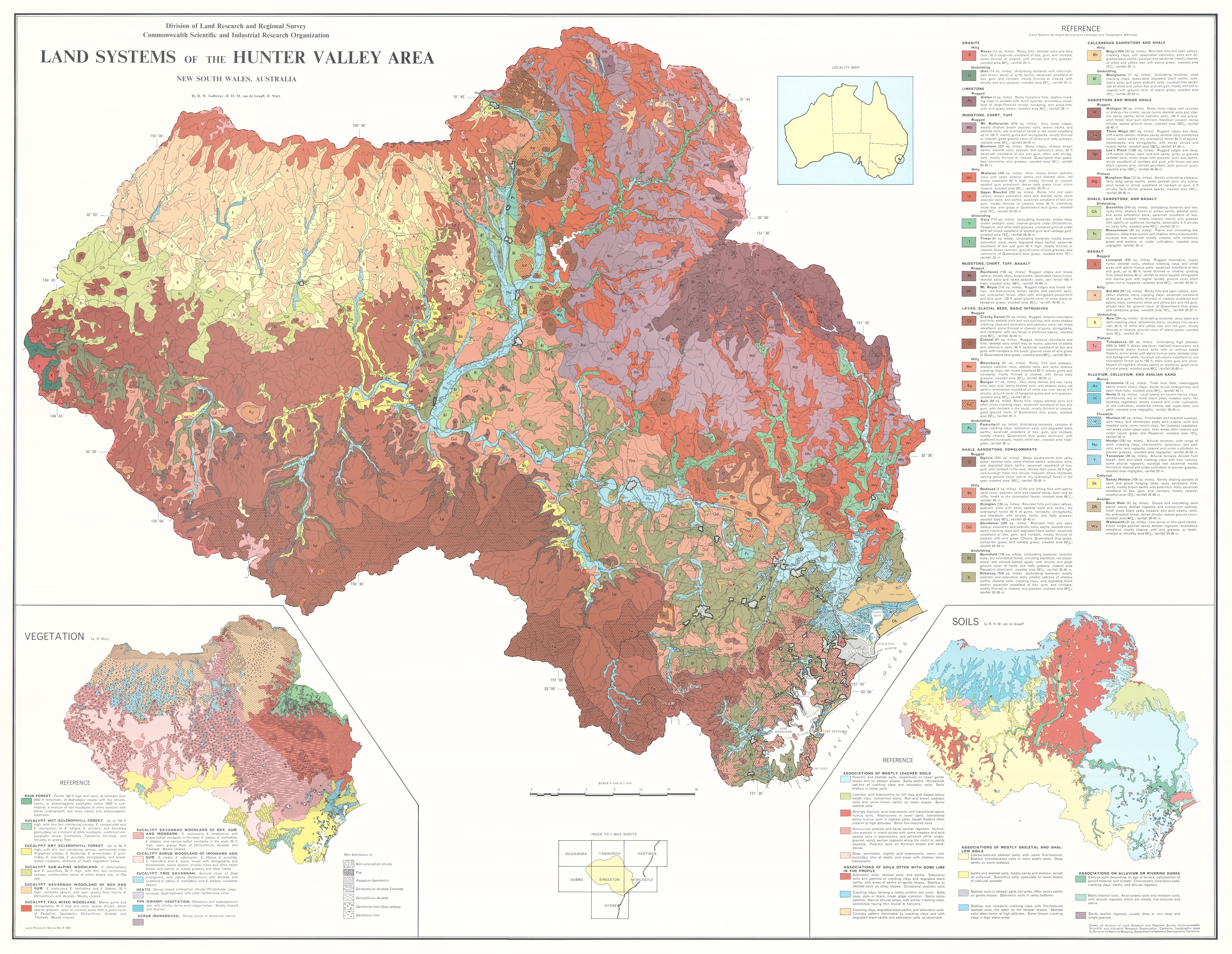
The survey covered an area of ~22,000 km2 and identified 43 land systems ranging in area from 285 km2 to 9,635 km2. In total, the survey team recognised and described the relative area and distribution, landforms, soils and vegetation of 112 land units with their position in the landscape shown on block diagrams in the report.
The report has five individual chapters:
- Geology — describes the geologic setting in terms of four broad provinces, outlines geological history and describes the controlling influence of lithology on land systems
- Geomorphology — recognises eight types of country and describes geomorphic history (including the effect of settlement on erosion and exacerbated flooding), and details relationship between geomorphic criteria and land systems with emphasis on lithological factors that have controlled the development of landforms
- Soils — describes factors that control soil formation, discusses soil classification schemes, and considers soils in terms of Great Soil Groups and Soil Families and the extent of their occurrence in the 43 land systems
- Vegetation — identifies three major vegetation types, describes 16 subdivisions and outlines their relation to habitat, with a discussion of key issues in the exploitation of vegetation
- Climate — describes principal climatic controls and general characteristics of rainfall, temperature, humidity, evaporation and water balance in relation to plant growth. This chapter also discusses soil properties as they relate to climatic influences, principally heat and moisture.
Map 1 — Land Systems of the Hunter valley, New South Wales, Australia by RW Galloway, RHM van de Graaff and R Story. Scale 4 miles to 1 inch. With insets: Vegetation by R Story and Soils by RHM van de Graaff. CSIRO Land Research Series No. 8, 1963.
https://doi.org/10.1071/LRS08
© CSIRO 2010