

No. 9 General Report on Lands of the West Kimberley Area, W.A.
Land Research Surveys
2010(1) 1 - 228
Published: 2010
Abstract
CSIRO’s survey of the West Kimberley area covered about 122,000 km2, including the two important coastal towns of Derby and Broome, the inland centre of Fitzroy Crossing and extending east almost to Halls Creek. The survey met a repeated request by the Western Australian government faced with both land degradation and continuing pressure for further developments.
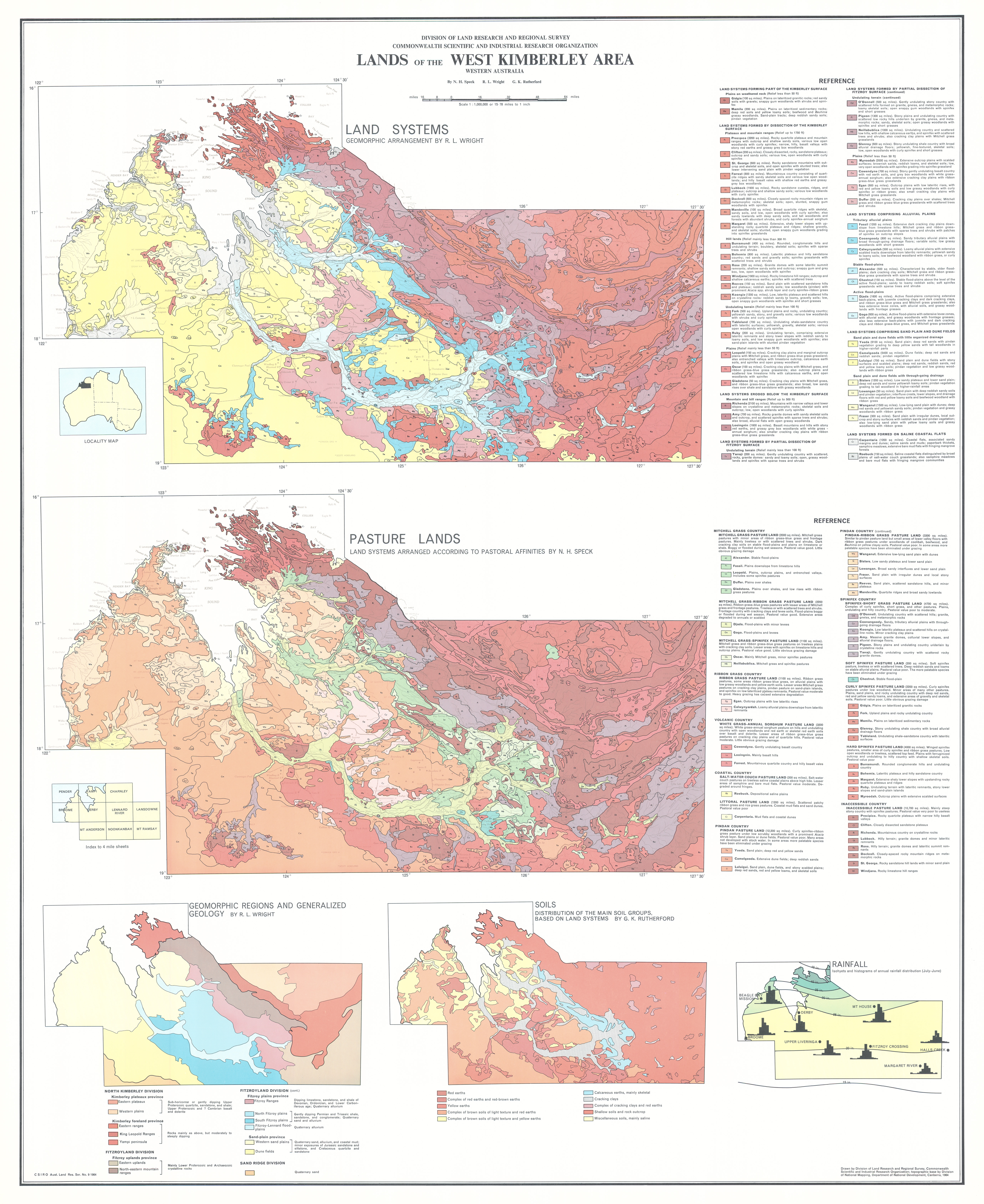
Field survey commenced in 1959 and identified 50 land systems ranging from 130 km2 to 15,800 km2 though mostly less than 5,400 km2. The report identifies between two and eight land units in each system and describes the area, landforms, soils and vegetation of 265 land units. The relative positions are shown on block diagrams with general descriptions of the geology and geomorphology of each land system.
The report includes chapters describing:
- Geomorphology — five physiographic divisions divisible into regions in which there is a ‘unity’ in the relief and evolution of the landscape
- Soil Types — areas that could be considered for irrigation while noting their likely limitations
- Climate — meteorology and climatic characteristics, and relating climate to plant growth and animal production
- Vegetation and Pastures — features of upper and lower story plant associations
- Pasture Lands — additional information on location, area, environment, composition, pastoral value and response to grazing
- The Pastoral Industry — the beef and sheep industries
- Agricultural Potential — the potential for rain-fed and irrigated agriculture
Map 1 — Lands of the West Kimberley area, Western Australia. Two maps on sheet, each scale 1:1,000,000: Land Systems by RL Wright; Pasture Lands by NH Speck. With insets: Geomorphic Regions and Generalized Geology by RL Wright; Soils by GK Rutherford and Rainfall. CSIRO Land Research Series No. 9, 1964.
Editor's Note: As well as ongoing pastoral and pearl industries, the area now has major importance for mining and tourism, and considerable potential for gas, bauxite and other mineral developments.
https://doi.org/10.1071/LRS09
© CSIRO 2010