

No. 12 General Report on Lands of the Wanigela–Cape Vogel Area, Territory of Papua and New Guinea
Land Research Surveys
2010(1) 1 - 107
Published: 2010
Abstract
The Wanigela–Cape Vogel area covers nearly 24,800 km2 in the Oro and Milne Bay Provinces of eastern Papua with five major types of environment — Southern Mountains, Central Plains, Northern Volcanic Mountains, Eastern Low Mountains, Hills and Plains, and Coastal Flats. This was CSIRO’s second survey in PNG and like the first survey, it overcame many difficulties. Vertical aerial photography coverage was limited and only oblique photography of marginal value was available for most of the remainder. Access for traverses and site observations was difficult.
Officers of other government departments undertook complementary studies to CSIRO’s specialists in climate, pedology and vegetation and land capability assessment. The team had no landform specialist and the report lacks the usual geomorphology chapter.
The survey identified 24 land systems ranging from 13 km2 to 870 km2 in six groups — erosional mountains, erosional hills, volcanic slopes, high terraces, fluviatile plains, and littoral plains. Block diagrams are provided for 14 land systems with sufficient relief. A plan view is given for one of the remaining 10. Of the 24 land systems, 14 have two or more land units for which individual descriptions are provided.
Land capability assessment ranges from Class II (moderately high with some limitations to cultivation) to Class VIII (very low or nil except for watershed protection). The report indicates that 22% of the area is in land systems with moderately high agricultural potential, 17% moderate and 61% low to nil.
Individual chapters cover:
- Climate — controls, general characteristics and relations to plant growth and land use
- Soils — characteristics including parent material, landform and vegetation of 38 soil families and their distribution in the land systems
- Vegetation — description of 14 formations and their distribution in the six land system groups
- Land Use Potential — description of the classes and subclasses
- Forest Resources — classification and productivity of forest types
Map 1 — Land Systems of the Wanigela–Cape Vogel area, Territory of Papua and New Guinea by HA Haantjens and BW Taylor. Scale 1:250,000. With inset: Regional Land Use Potential by HA Haantjens. CSIRO Land Research Series No. 12, 1964.
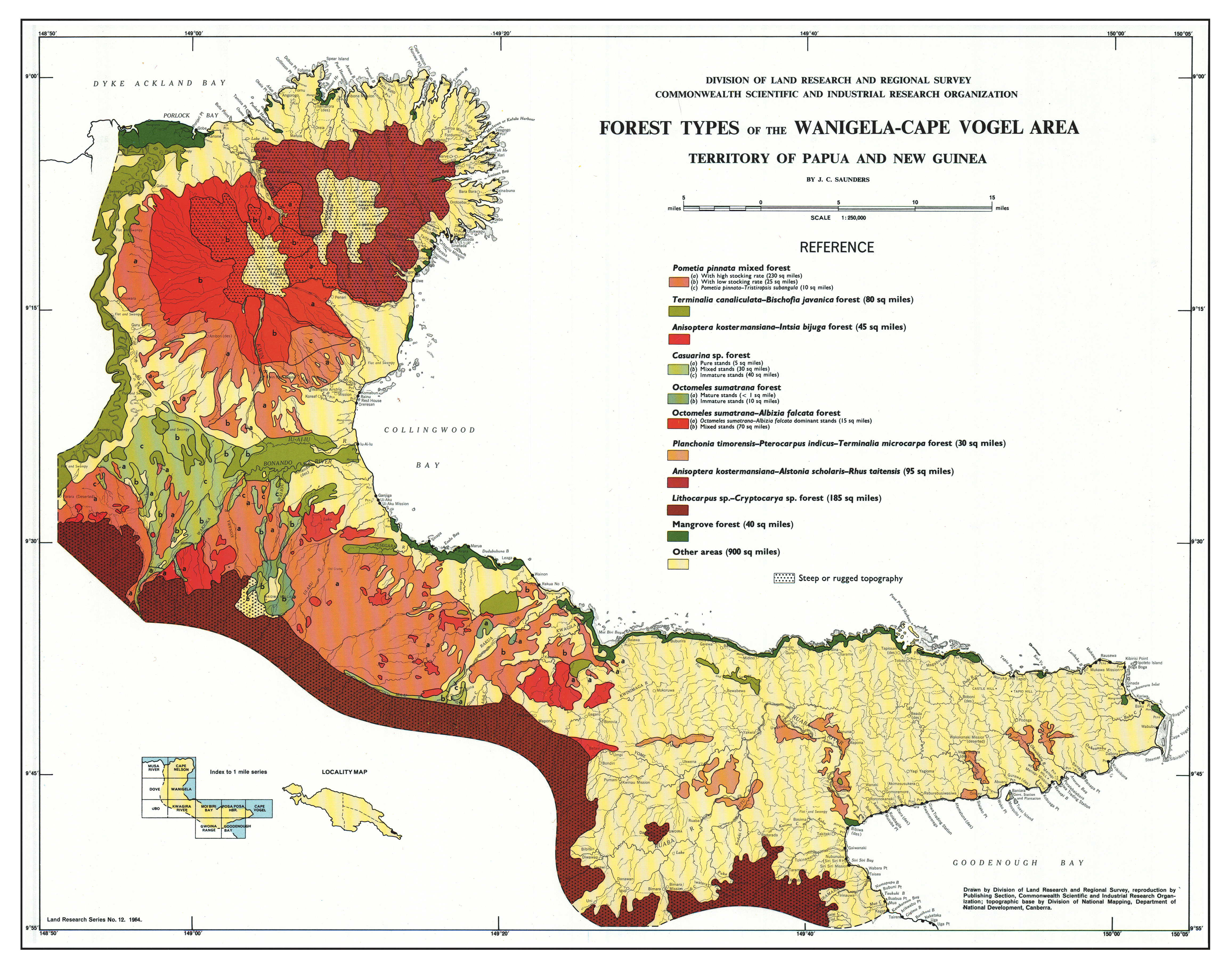
Map 2 — Forest Types of the Wanigela–Cape Vogel area, Territory of Papua and New Guinea by JC Saunders. Scale 1:250,000. CSIRO Issued with Land Research Series No. 12, 1964.
Editor's Note: Since the survey, the area’s population has increased from 14,000 to about 30,000 in 2011.
https://doi.org/10.1071/LRS12
© CSIRO 2010