

No. 16 Geomorphology of the Leichhardt–Gilbert Area of North-west Queensland
Land Research Surveys
2010(1) 1 - 66
Published: 2010
Abstract
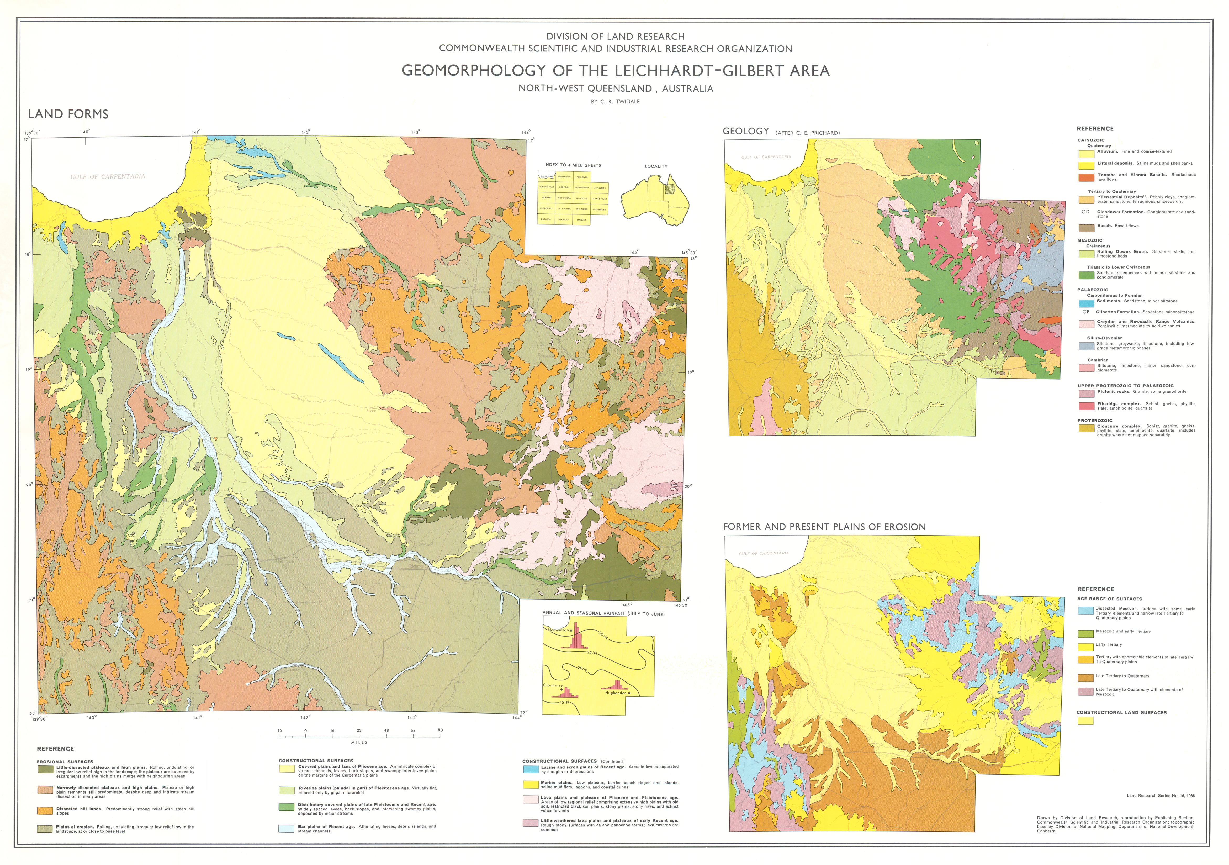
Land systems of the Leichhardt–Gilbert area are described in Report No. 11 . The original survey covered an area of about 300,000 km2 in northwest Queensland and identified 61 land systems in three physiographic divisions — two upland and an intervening area of broad erosional and alluvial lowland plains with the easterly upland province including some volcanic (lava) plains.
This report is a specialised account of the landforms of the area, their evolution and underlying structural and causal factors. It deals broadly with major structural and relief units and their trends, and the control exercised by mountain building and by uplift and tilting of the earth surface, as well as by its lithology, stratigraphy and climate. It describes their expression in drainage systems, river regimes, stream patterns and channel characteristics.
The report also provides more detail for the three physiographic divisions, describing the geology, drainage and landforms of 12 subdivisions of the Carpentaria and Inland Plains, 15 subdivisions of the Einsleigh uplands, and a single unit in the Isa Highlands.
Map 1 — Geomorphology of the Leichhardt–Gilbert area, north-west Queensland, Australia by CR Twidale. Scale approx. 24 miles to 1 inch. With insets: Geology (after CR Prichard); Former and Present Plains of Erosion. CSIRO Land Research Series No. 16, 1966.
https://doi.org/10.1071/LRS16
© CSIRO 2010