

No. 35 Explanatory Notes to the Vegetation Map of Papua New Guinea
Land Research Surveys
2010(1) 1 - 45
Published: 2010
Abstract
Land System and Land-Form Type mapping in CSIRO’s Land Research Series covers about 40% of Papua New Guinea. This report collates vegetation information from these reports and supplements it with new mapping. The novel procedure for mapping using aerial photography is explained in the report.
A primary distinction is made between nine major categories of vegetation and these are subdivided into 24 types that are mapped and summary descriptions are provided in the map legend.
The report provides detailed descriptions of the vegetation types to supplement the legend and assist interpretation of the map. Terms used in description of the various types are explained. The descriptions also give details of floristic composition of each vegetation type.
The report has 11 annotated aerial photograph clips illustrating the pattern and position of selected vegetation types. These are complemented by 21 photographs illustrating vegetation types and their environment.
Map 1 — Vegetation Map of Papua New Guinea (sheet 1 of 4) by K Paijmans. Scale 1:1,000,000. CSIRO Land Research Series No. 35, 1975.
Map 2 — Vegetation Map of Papua New Guinea (sheet 2 of 4) by K Paijmans. Scale 1:1,000,000. CSIRO Land Research Series No. 35, 1975.
Map 3 — Vegetation Map of Papua New Guinea (sheet 3 pf 4) by K Paijmans. Scale 1:1,000,000. CSIRO Land Research Series No. 35, 1975.
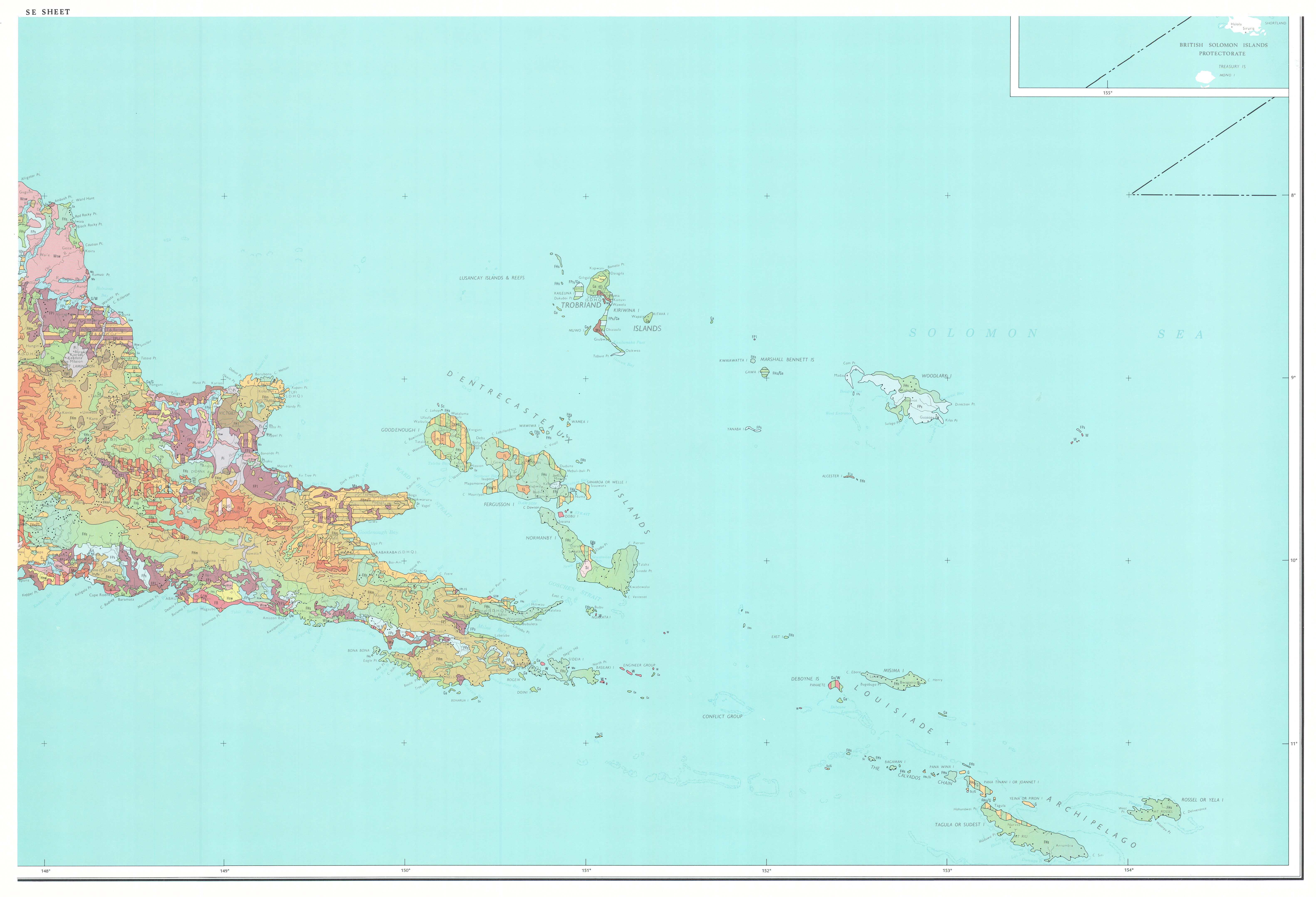
Map 4 — Vegetation Map of Papua New Guinea (sheet 4 of 4) by K Paijmans. Scale 1:1,000,000. CSIRO Land Research Series No. 35, 1975.
https://doi.org/10.1071/LRS35
© CSIRO 2010