

No. 37 Lands of the Ramu–Madang Area, Papua New Guinea
Land Research Surveys
2010(1) 1 - 148
Published: 2010
Abstract
The Ramu–Madang survey covered an area of approximately 20,460 km2 or about three quarters of Madang Province, with altitude ranging from sea level to ~3,000 m in five physiographic categories. Field surveys were undertaken in 1956 and 1958. Unpublished reports were revised for publication in 1976.
The report lists 36 land systems in six groups — mountains, hills, fans, coastal plains, flood plains and swamps. They range from 26 km2 to 2,590 km2 and a general description is provided for their geology, physical features, and population and land use, with a general assessment of potential value and use. From two to seven land units were identified for 30 land systems and single units only for the other six.
The area, landforms, soil and drainage status, vegetation and land class are recorded for 108 land units. Their positions are shown on block diagrams for 24 of the 36 land systems.
Individual disciplinary chapters describe:
- Climate — principal features and controls; general rainfall, temperature and other characteristics; and soil moisture (water balance) regimes
- Geomorphology — characteristics of five major regions; geomorphological history, and processes related to erosional and depositional landforms
- Soil Families — distribution of 11 soil groups and 74 families in the land systems groups and factors in soil formation
- Vegetation and Ecology — characteristics of five main types of plant community and their 20 sub-types; and the ecology of coastal, swamp, alluvial, hilly-mountainous and grassland environments
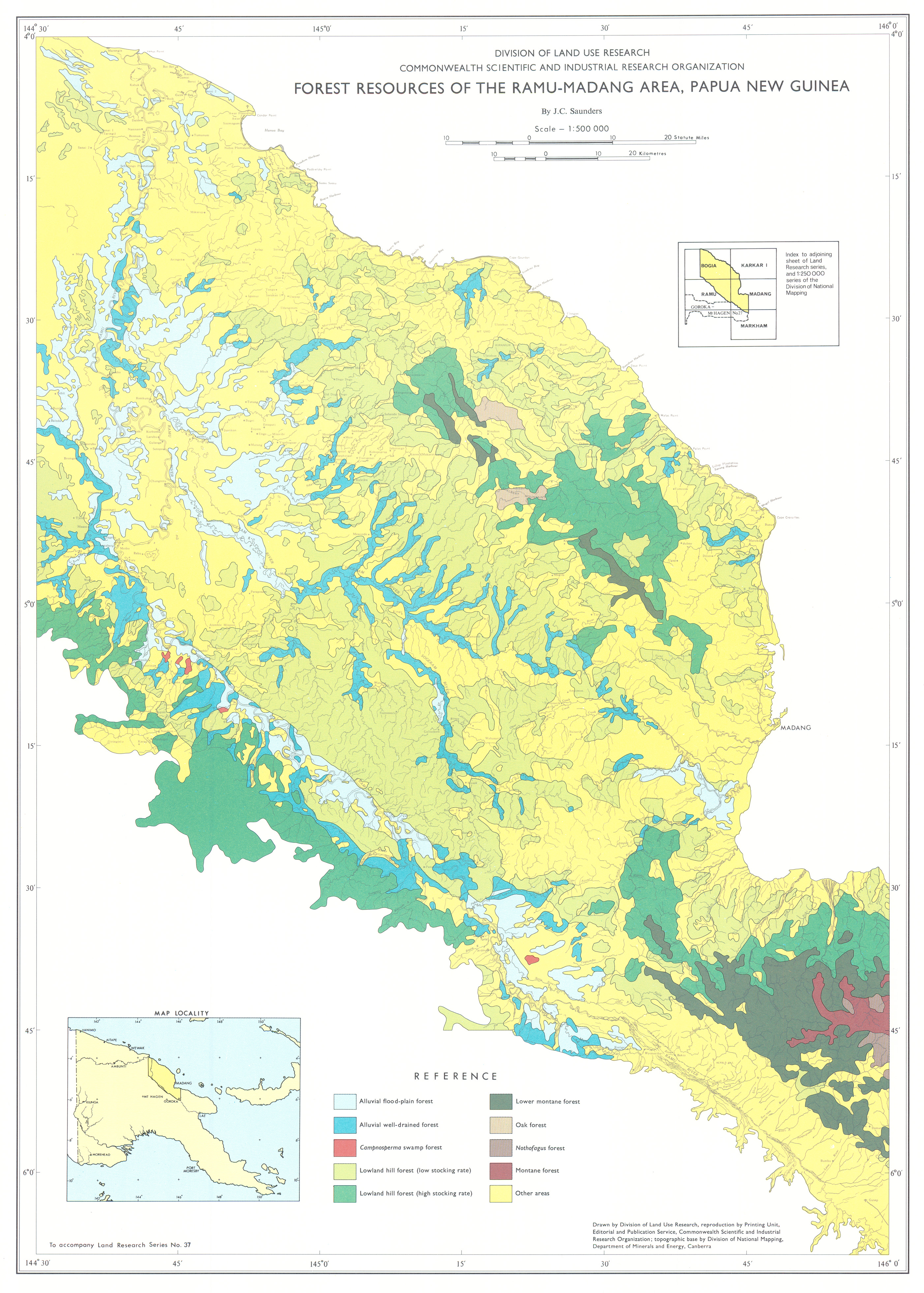
- Forest Resources — methods, classification and mapping of eight forest types and access categories; and frequency of key tree species in the eight main types
- Land Use Capability — nature and distribution of five broad categories of land use potential and their subdivisions in relation to the land systems in which they occur
Map 1 — Land Systems of the Ramu–Madang area, Papua New Guinea by HA Haantjens, E Reiner, RG Robbins and JC Saunders. Scale 1:250,000. CSIRO Land Research Series No. 37, 1976.
Map 2 — Forest Resources of the Ramu–Madang area, Papua New Guinea by JC Saunders. Scale 1:500,000. CSIRO Land Research Series No. 37, 1976.
Editor's Note: The population of 74,000 at the time of the survey approaches 250,000 in 2011.
https://doi.org/10.1071/LRS37
© CSIRO 2010