

No. 5 Pasture Lands of the Northern Territory, Australia
Land Research Surveys
2010(1) 1 - 65
Published: 2010
Abstract
This specialist report covers pasture lands in the Northern Territory as a whole beginning with a review of literature and relevant maps. It provides a table to match pasture groups described in this report with groupings used by other authors. It then outlines the general physical environment — physiography, climate, soils, vegetation and the impact of fires and animals — and describes the pastoral industry of the late 1950s.
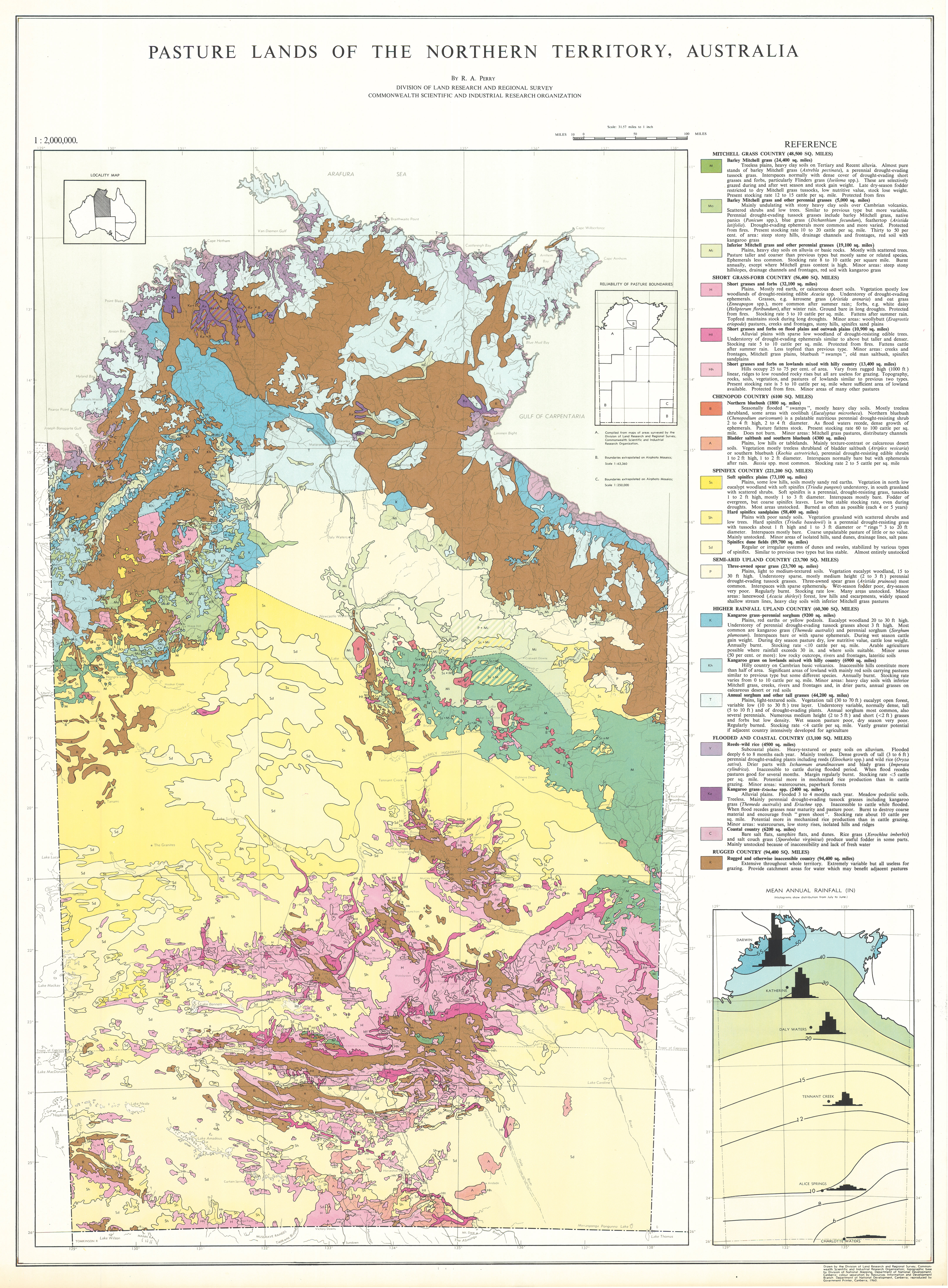
The main part of the report is a description of the characteristics and ‘potentialities’ of eight broad pasture groups. These are subdivided into 19 types of country called ‘pasture lands’, each of which is described in terms of its area, location, environment, composition and structure and associated minor communities. This is followed with an assessment of growth cycle and pastoral value, water availability, management practices, present and potential productivity, and reaction to grazing pressure.
The legend for the 1:2,000,000-scale map summarises topography and relief and aspects of pasture condition and carrying capacity.
Map 1 — Pasture Lands of the Northern Territory, Australia by RA Perry. CSIRO Land Research Series No. 5, 1960.
https://doi.org/10.1071/LRS05
© CSIRO 2010