

No. 39 Land Units of the Fitzroy Region, Queensland
Land Research Surveys
2010(1) 1 - 228
Published: 2010
Abstract
This is last report in the CSIRO Land Research Series, representing the culmination of the evolving approach to its land resource surveys in mainland Australia. It implements a radical change that began with the report on the Dawson–Fitzroy Area (No. 21). Later, the report on the Balonne–Maranoa Area (No. 34) added a new nomenclature for land systems reflecting parent material, relief and vegetation and increased the information on land units.
This report consolidates and restructures information from three earlier reports covering the same area (No. 18, No. 19 and No. 21). The three surveys identified a large number of complex land units (863) many of which were repetitive in different land systems. The Dawson–Fitzroy report had adopted the concept of land facets to elucidate relationships between its 535 land units and 63 land systems. This report attempts to reorganize information to further assist identification of a smaller, more realistic number of simple land units (142) that are the components of the complex units used to describe land systems in the three earlier surveys.
Three chapters explain the criteria used:
- Geomorphology, Soils and Mode of Occurrence — recognising geomorphic categories, rock types, landforms (terrain types relating to relief and slope), position in the landscape and catenary sequences of soil classes as defining elements of simple land units
- Climate — describing major climatic elements and identifying climatic zones
- Vegetation — identifying major structural categories of vegetation with descriptions in terms of plant formations and communities
The bulk of the report then gives a description of each land unit including:
- a thumbnail map showing location and area
- diagnostic features and rainfall characteristics
- aerial photos, one pinpointing an example, one unmapped for comparison
- soil and vegetation criteria and land capability ratings
- Further information is given in appendices.
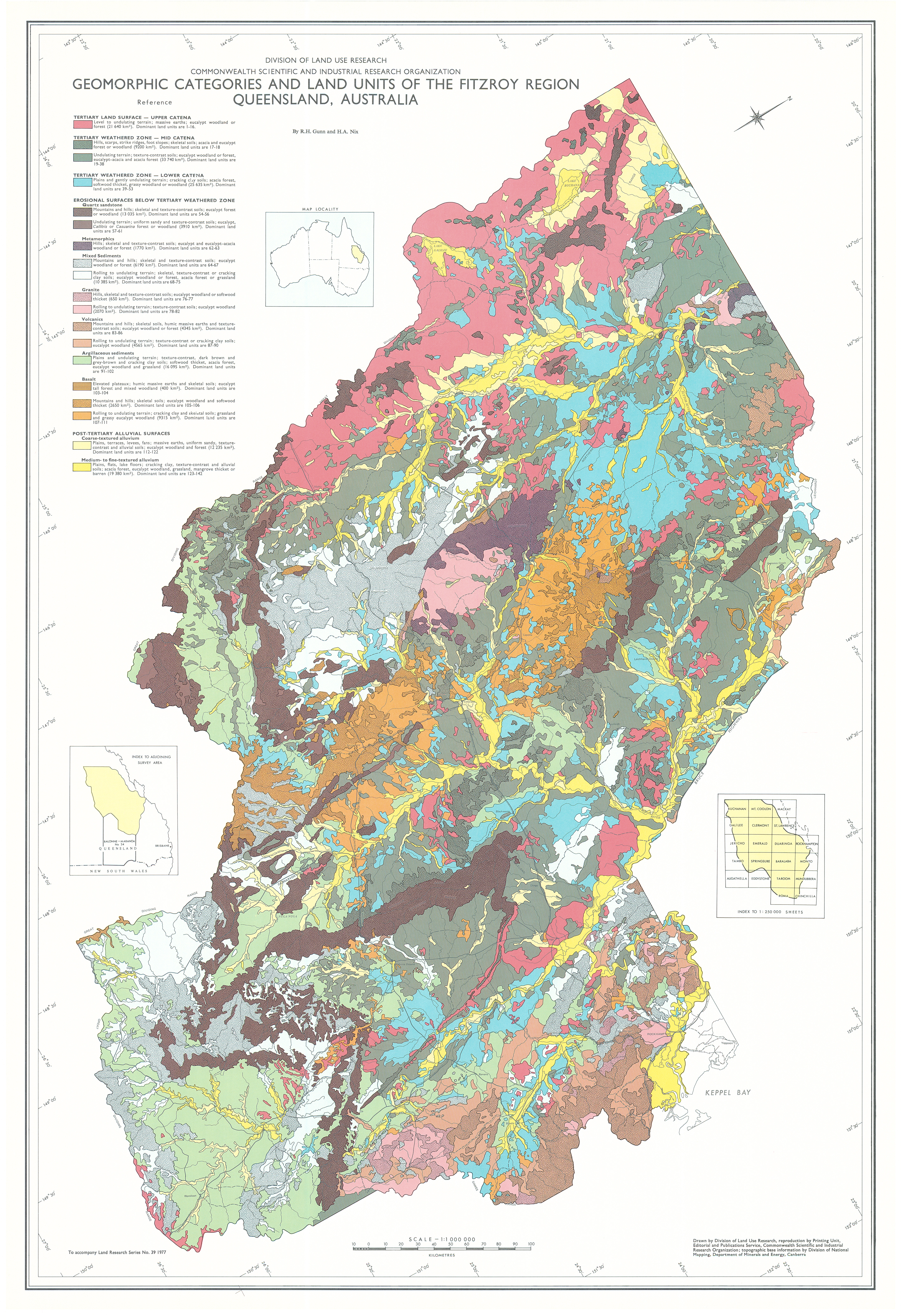
Map 1 — Geomorphic Categories and Land Units of the Fitzroy Region, Queensland, Australia by RH Gunn and HA Nix. Scale 1:1,000,000. CSIRO Land Research Series No. 39, 1977.
Map 2 — Distribution of Major Structural Groups of Vegetation of the Fitzroy Region, Queensland, Australia by HA Nix. Scale 1:1,500,000. CSIRO Land Research Series No. 39, 1977.
https://doi.org/10.1071/LRS39
© CSIRO 2010