

Evolving Approaches to Land Classification
Development of the concept of land systems in the first survey in 1946 was an outstanding innovation in land evaluation and a major step in the development of the scientific discipline now known as “landscape ecology”. It met the critical need at that time to be able to determine development potential without detailed investigation of the whole area.
While the survey teams were gaining experience in this systematic approach to land evaluation, there were continuing advances within the individual disciplines, particularly in approaches to geomorphology and the classification of soils and vegetation. CSIRO’s scientists contributed to this research and development, but there were increasing contributions from overseas. Its major influence is seen in approaches to terrain analysis in both Australia and Papua New Guinea – with the development of parametric analysis of slope and relief elements. In the Papua New Guinea reports it is also evident in approaches to soil classification with the adoption, adaptation and supplementation of the US Soil Conservation Service’s Soil Classification 7th Approximation.
Near Lawn Hill–Riversleigh on the Barkly Tableland, Northern Territory–Queensland 1948
In Australia, soil survey moved from the traditional description based on Great Soil Groups and the updated version in the Handbook of Australian Soils to the use of a factual key (the “Northcote Classification”), but the reports continued to identify soil associations and present the information as descriptions of the characteristics of soil families. The Northcote classification has been superseded by the Australian Soil Classification, but this was not generally adopted until after 1996 – well beyond the end of the land system survey program. The Australian Soil Resource Information System (ASRIS) now provides a standardised hierarchy for soil mapping related to typical uses for the information at appropriate levels of resolution.
Similarly, the reports show variety in the approach to vegetation classification. This is perfectly illustrated in the three Fitzroy Region surveys (Nos. 18, 19 and 21) each of which used a different system. These were superseded by a classification based on structural formations (the Specht system) that was used in the final Report in 1977 (No. 39), a radical study that consolidated the three earlier reports. The Specht system has now been superseded by the Australian Soil and Land Survey Handbook’s classification scheme, based on collection of primary rather than class data.
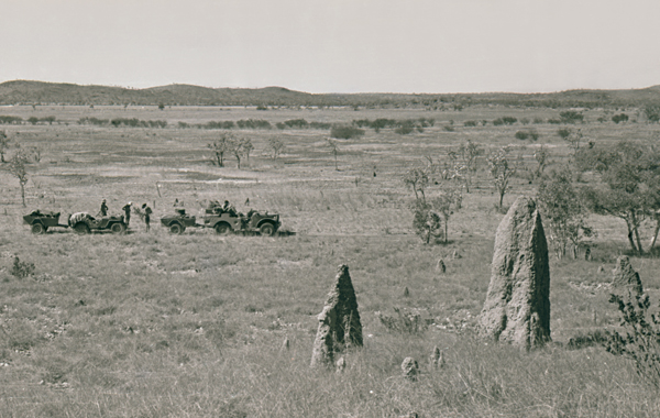
About 29 km south of Rollestone Queensland, Isaac–Comet Survey 1962
The nomenclature of land systems also changed late in the program. Previously, land systems had been named for localities or important features in the area where they occurred – mountains, rivers, villages, homesteads etc. The map symbols were developed from these names (e.g. Ba for Barwon and Bl for Blackwater). In Australia, the report on the Balonne–Maranoa Area (No. 34) adopted a new nomenclature using letters reflecting parent material, relief and vegetation, but this was not followed in the last mainland survey of the Alligator Rivers Region (No. 38). Letter identifiers also replaced names for the Eastern Papua Report (No. 32) and later reports in Papua New Guinea.