

Atlas helps us see what’s happening with global carbon emissions
Ecos 2013(190) - https://doi.org/10.1071/EC13284
Published: 9 December 2013
|
Launched in Europe and Australia last month, the Atlas is backed by the CSIRO-supported Global Carbon Project, led in Australia by CSIRO researchers, Drs Pep Canadell and Mike Raupach.
The Atlas will assist government agencies, industry, non-governmental groups, research institutions, educators and the community to view maps and infographics, and interrogate scientific data on carbon emissions and removals associated with human-induced climate change.
Sponsored by the French banking institution, BNP Paribas, the Global Carbon Atlas is based on data from more than 216 countries. Multiple biogeochemical models provide additional information on the function of natural carbon sinks on land and oceans.
Dr Canadell points out that emissions have now increased by 54 per cent above their 1990 levels, and carbon dioxide in the Northern Hemisphere exceeded 400 parts per million in winter for the first time in the last 800,000 years.
Natural ocean and land carbon sinks (for example forests, grasslands and marine algae) have absorbed half of the carbon released by human emissions.
‘The Atlas is a tool to find out which countries are the biggest emitters, where carbon from emissions gets re-absorbed by land and oceans, how this process occurs, and what happens when the carbon is released back into the atmosphere,’ said Dr Canadell.
According to its website, the Atlas offers areas of application:
-
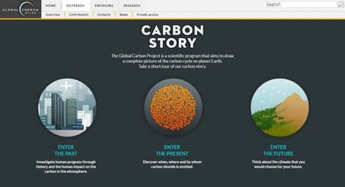
OUTREACH enables users to trace the history and possible future relationship between carbon emissions and human development. While intended as an educational experience for non-scientists, it utilises current observations and modelling from climate change science.
-
EMISSIONS is a tool to explore, display and download data and figures on carbon dioxide emissions from the combustion of fossil fuels, cement production and land use change over multiple decades. Information is available at the global, regional and national levels and users can compare, rank and visualise changes over time.
-
RESEARCH provides tools to create custom global and regional maps and time series of carbon fluxes from research models and datasets from many participating research institutions. This component will further advance collaborative international research on the functioning of the carbon cycle and its interactions with the climate system.
The Global Carbon Project is supported through the Australian Climate Change Science Program.
Source: CSIRO