

No. 33 Explanatory Notes to the Geomorphological Map of Papua New Guinea
Land Research Surveys
2010(1) 1 - 39
Published: 2010
Abstract
Land System and Land-Form Type mapping in CSIRO’s Land Research Series covers about 40% of Papua New Guinea. This report collates landform information from these reports and supplements it with new mapping, using both standard aerial photography and radar imagery and drawing on geological maps and other publications.
The map (in four sheets) is primarily an interpretation of air photo patterns. The report describes the procedures and explains the decisions necessary for compilation and presentation of a map that would be both informative and readable. A primary distinction is made between denudational, volcanic and depositional land forms but subdivision of these groups necessarily uses differing criteria.
The map legend incorporates relief as the most useful parameter for the dimension of landforms and rock type as a major determining factor of differences in other landform parameters such as dissection pattern, drainage density and slope form. The basis for classification of rock types is explained.
The report has three descriptive sections that are provided to supplement the legend and assist interpretation of the map:
- Denudational Land Forms — distinguishes landforms on the basis of (a) fluvial erosion and mass movement, (b) karst, and (c) glacial processes; differentiates between strong and weak structural control in the fluvial erosion and mass movement sub-group; and describes the 11 mapped denudational land forms
- Volcanic Land forms — outlines types of volcanoes and their distribution; and describes the five mapped volcanic land forms
- Depositional Land Forms — distinguishes fluvial and littoral processes; and describes the 16 mapped depositional land forms
- The report has 20 captioned plates that are clips from aerial photos illustrating land form types. Note: the report interchanges the terms ‘denudational land forms’ and ‘erosional land forms’.
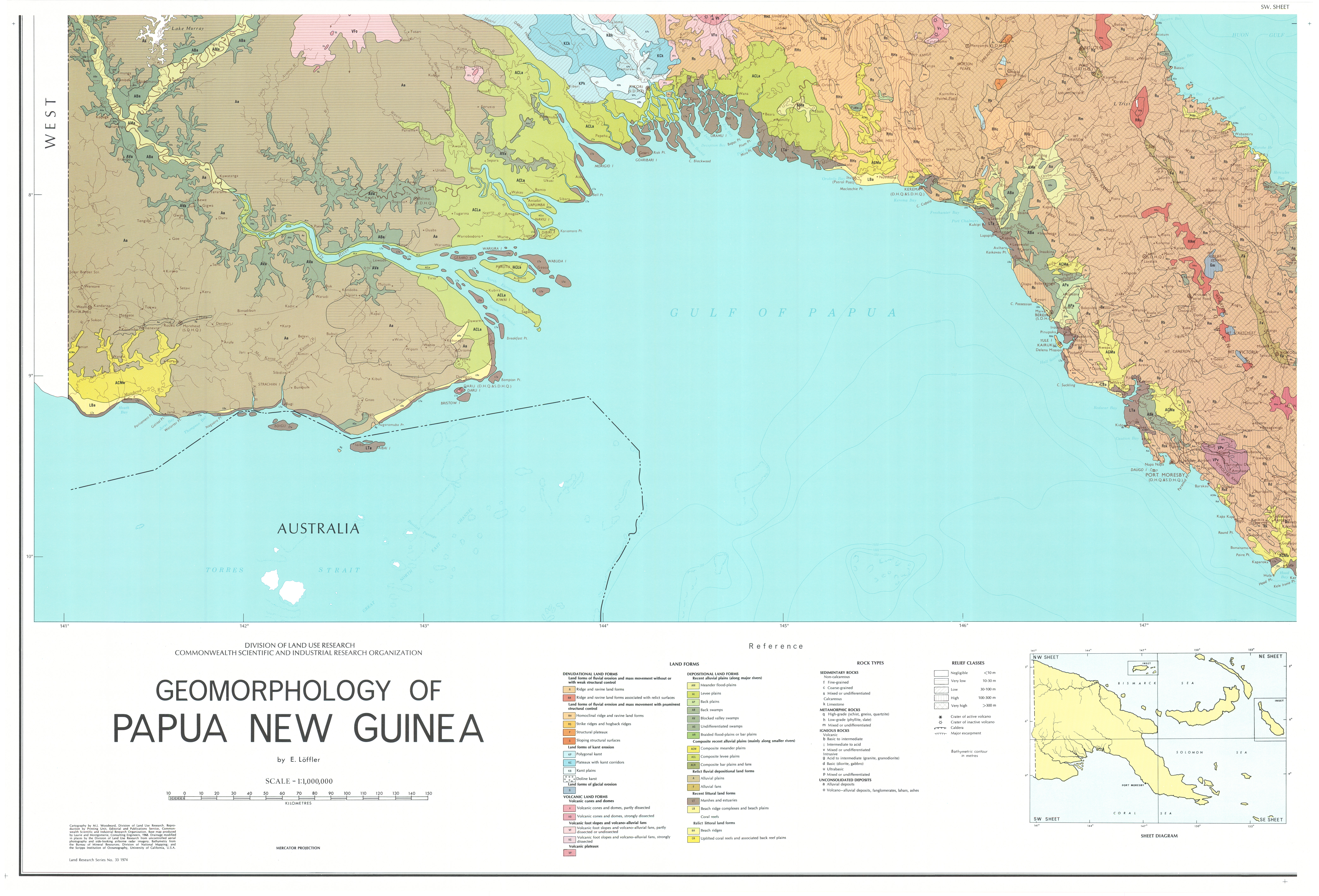
Map 1 — Geomorphological Map of Papua New Guinea (sheet 1 of 4) by E Löffler. Scale 1:1,000,000. CSIRO Land Research Series No. 33, 1974.
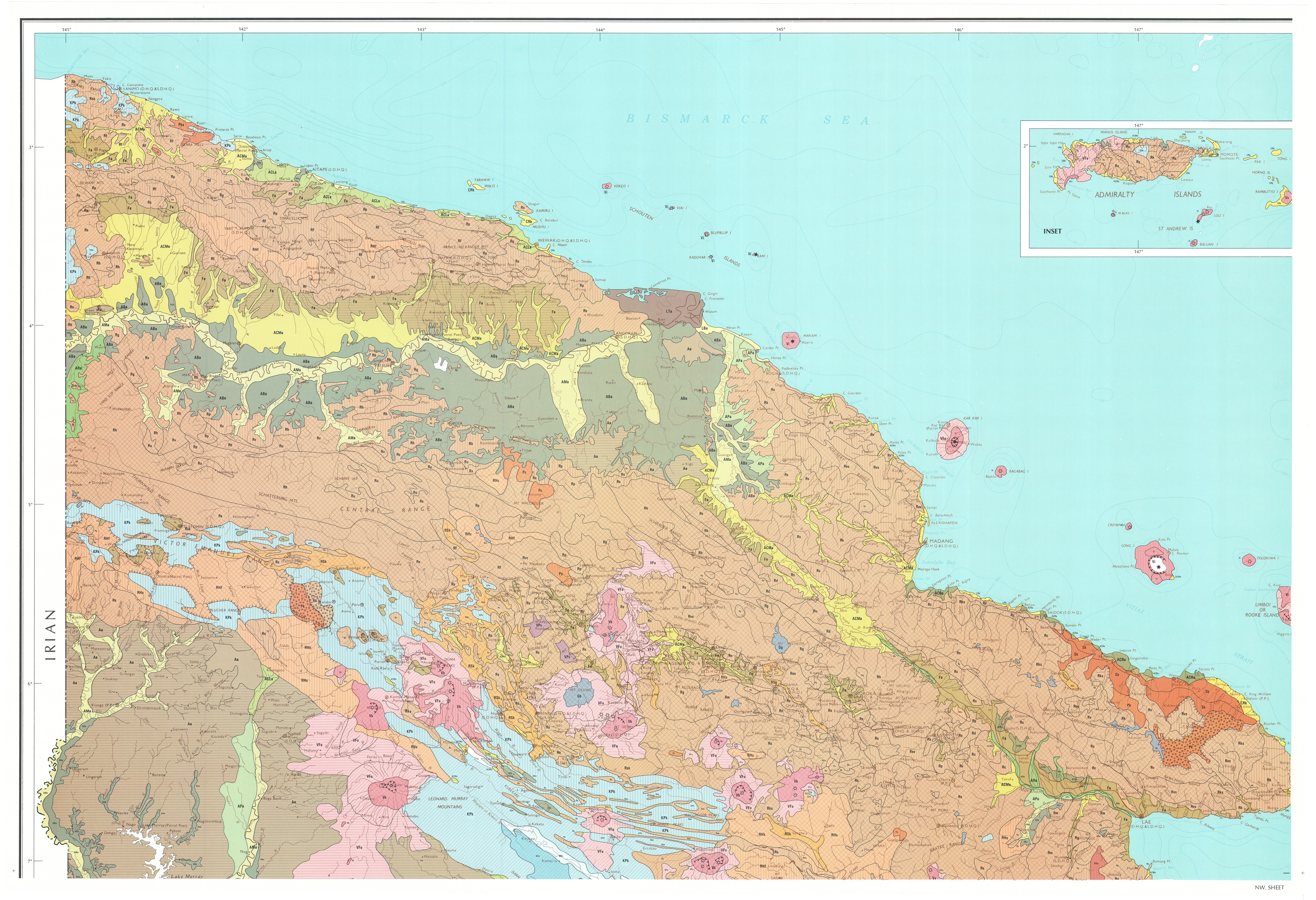
Map 2 — Geomorphological Map of Papua New Guinea (sheet 2 of 4) by E Löffler. Scale 1:1,000,000. CSIRO Land Research Series No. 33, 1974.
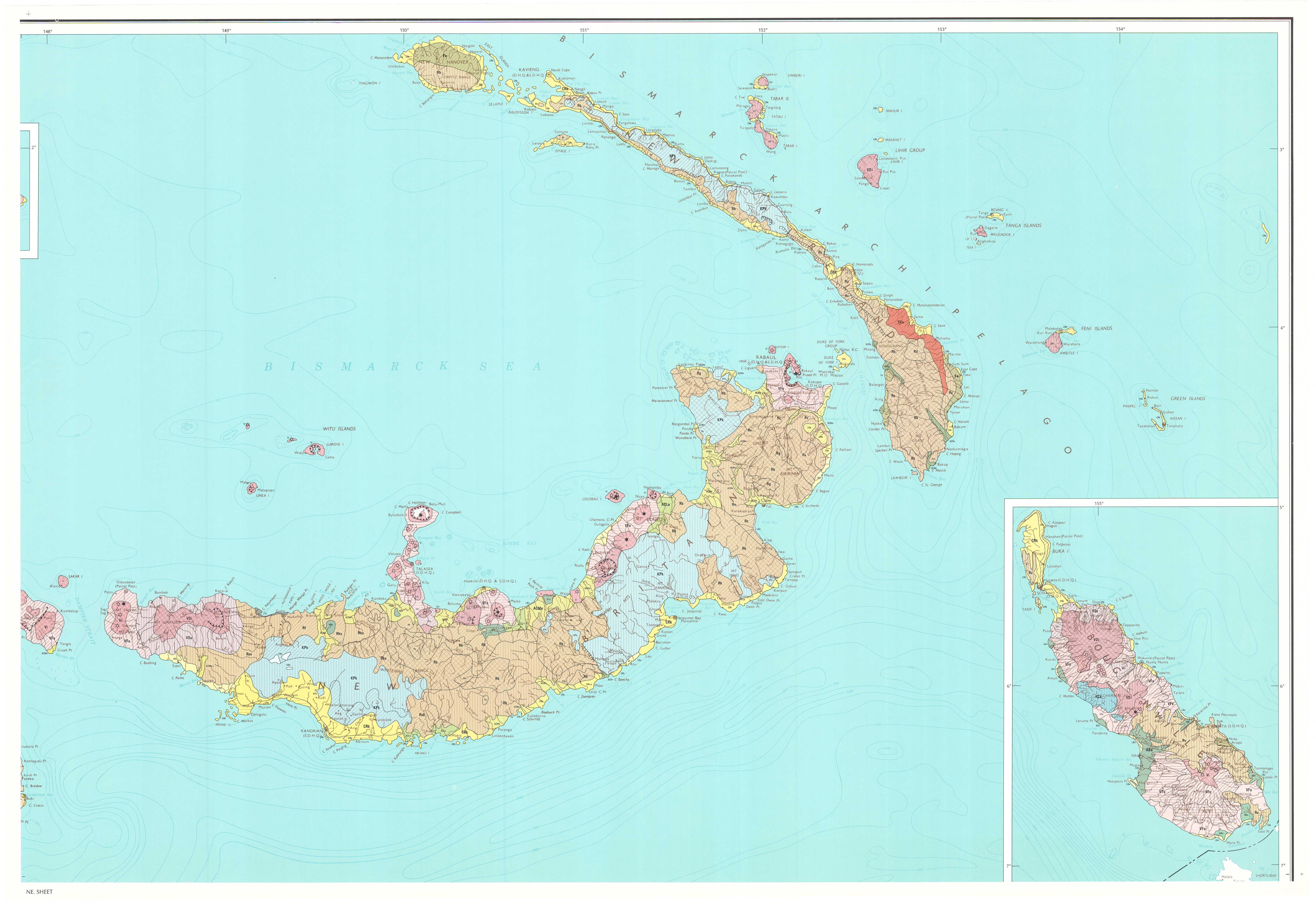
Map 3 — Geomorphological Map of Papua New Guinea (sheet 3 of 4) by E Löffler. Scale 1:1,000,000. CSIRO Land Research Series No. 33, 1974.
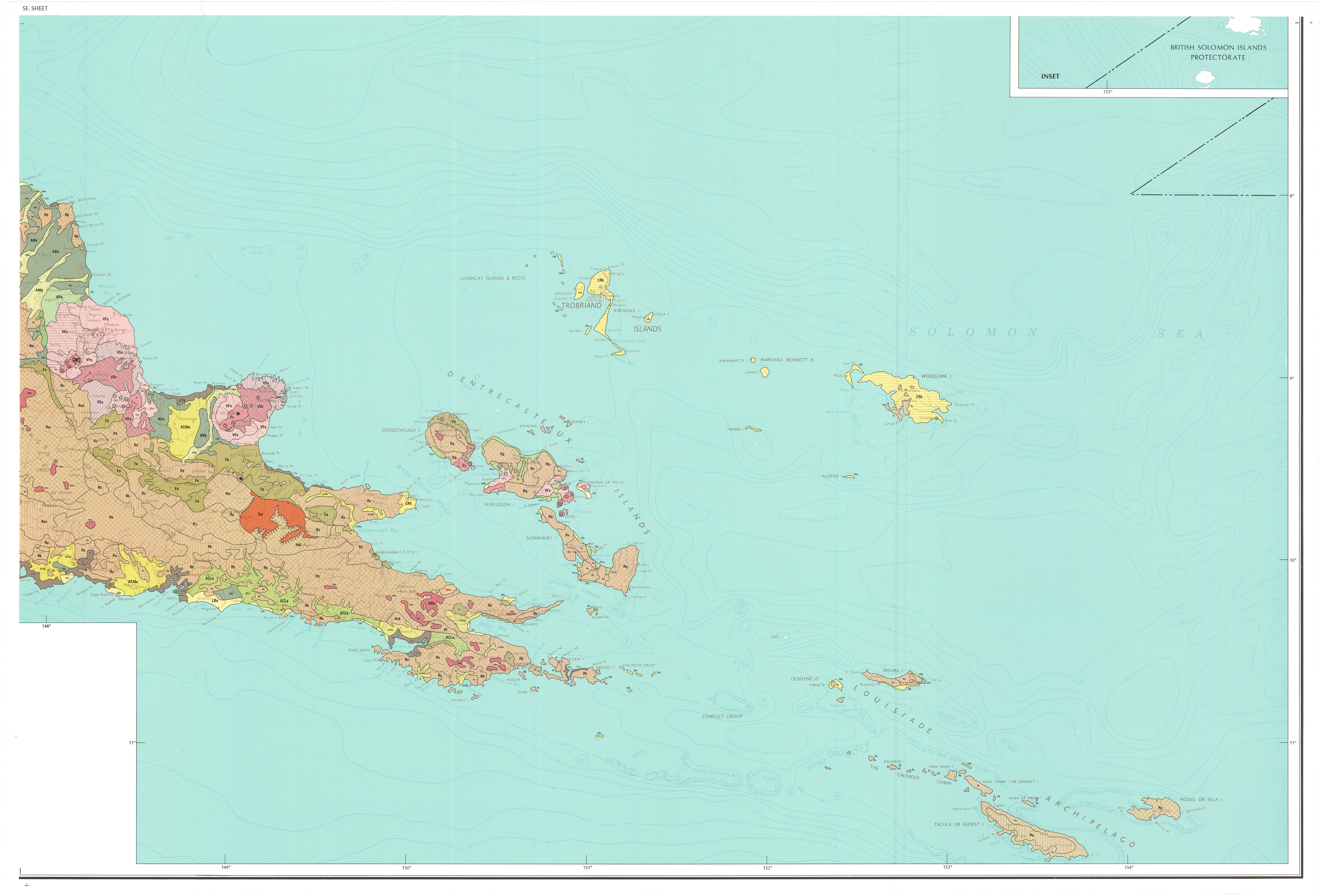
Map 4 — Geomorphological Map of Papua New Guinea (sheet 4 of 4) by E Löffler. Scale 1:1,000,000. CSIRO Land Research Series No. 33, 1974.
https://doi.org/10.1071/LRS33
© CSIRO 2010