
Published online 13 October 2025
WR25069Short-term impacts of large re-stocking on European hare population dynamics in a grassland landscape
Charles P. Henriot  , Léopold Berger, Thibaut Powolny, Régis Renaude, Christophe Bonenfant and Mickaël Sage
, Léopold Berger, Thibaut Powolny, Régis Renaude, Christophe Bonenfant and Mickaël Sage

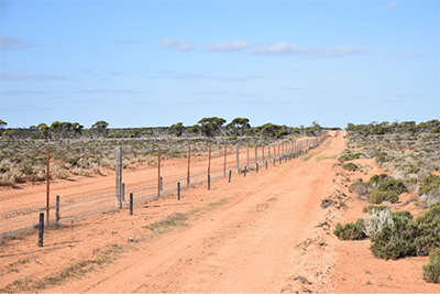
Reinforcement is increasingly used as a conservation strategy to limit population declines. This study assessed the impact of re-stocking on European hare population dynamics in a grassland (Jura Mountains, France), a habitat representative of declines in Europe, and showed limited short-term effects owing to low survival rates and high predation. We make recommendations to improve reinforcement success in the context. Photograph by Léopold Berger.