

No. 18 Lands of the Nogoa–Belyando Area, Queensland
Land Research Surveys
2010(1) 1 - 201
Published: 2010
Abstract
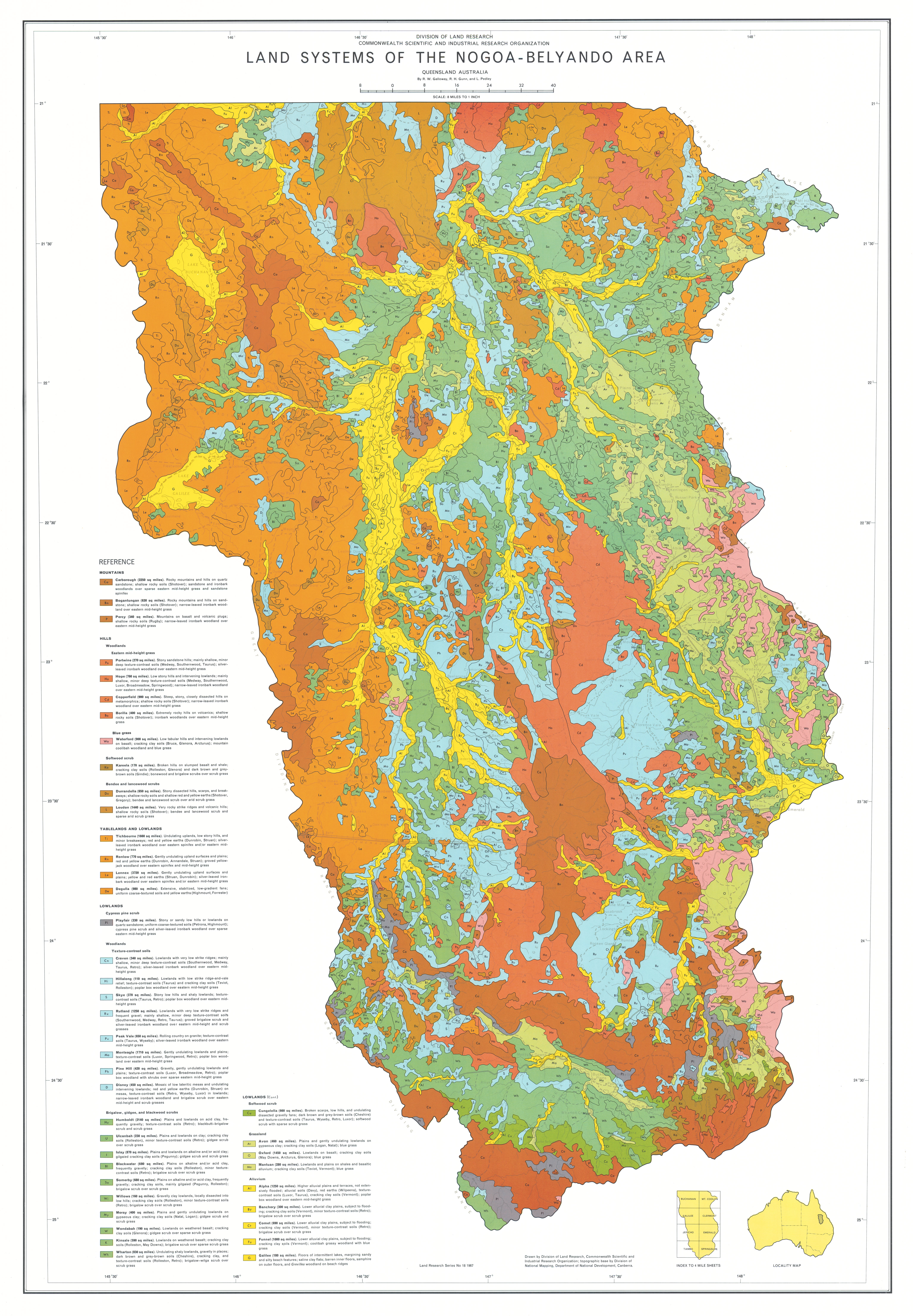
The Nogoa–Belyando survey was the last of three surveys encompassing brigalow lands of interest for agricultural development. The survey covered an area of 90,650 km2 with 43 land systems ranging in area from 285 km2 to 9,635 km2 with between two and seven land units in each.
The survey team recognised and described the relative area and distribution, landforms, soils, vegetation and land capability class of 201 land units (but see Report No. 39 for revisions to these findings) with their position in the landscape shown on block diagrams.
The report has seven individual chapters:
- Geology — describing geological history and the relation of lithology to land systems
- Geomorphology — recognising eight physical regions with distinctive relief and ‘broadly related complexes of soil and vegetation’ and describing geomorphic history and the relationship between geomorphic categories, relief categories and the lithology of land systems
- Soils — identifying the proportion of each land system within a catenary sequence of eight major soil groups and 35 families of soils
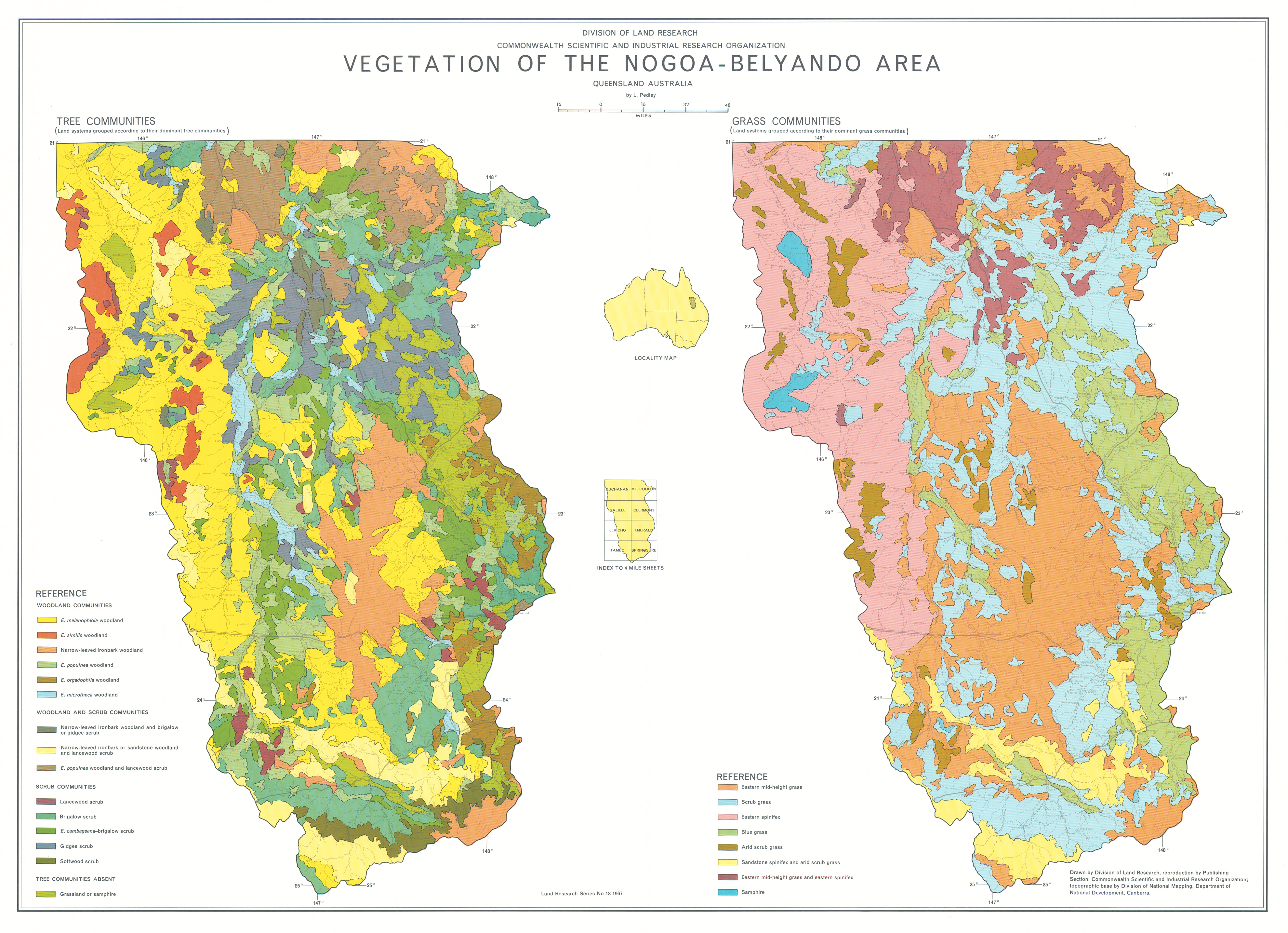
- Vegetation — described in terms of various woodland, scrub and grass communities
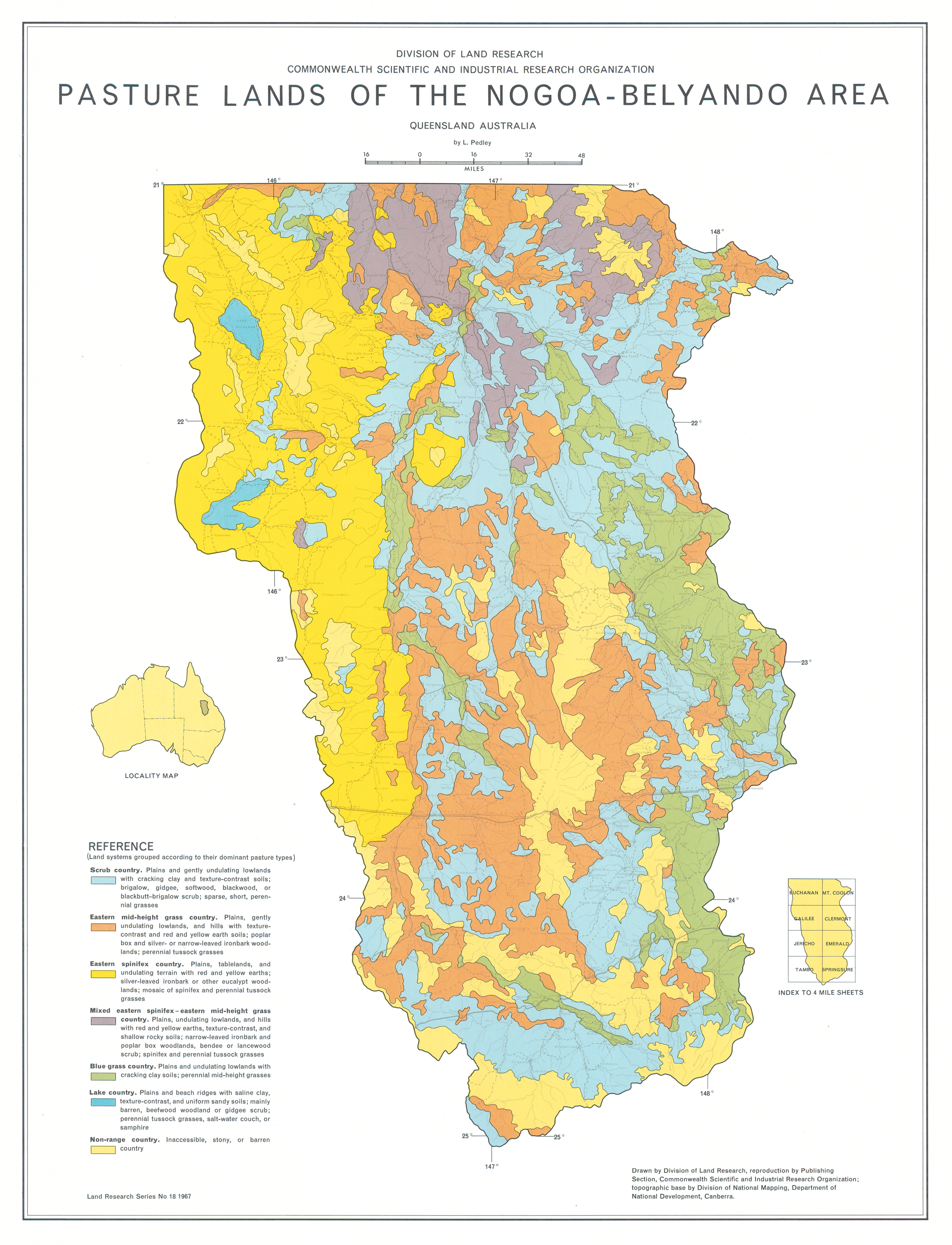
- Pasture lands — described in terms of the proportion of six recognised grass communities in each land system with the land systems allocated to seven types of pasture lands and with comments on factors affecting their carrying capacity
- Climate — describing principal climatic controls and general characteristics of rainfall, temperature, evaporation and other parameters
- Land Use — with further assessment of the relationships of climate and soils to present and potential use
Map 1 — Land Systems of the Nogoa–Belyando area, Queensland, Australia by RW Galloway, RH Gunn and L Pedley. Scale 8 miles to 1 inch. CSIRO Land Research Series No. 18, 1967.
Map 2 — Nogoa–Belyando area, Queensland, Australia. Two maps on sheet, each scale 16 miles to 1 inch: Geology and Geomorphology by RW Galloway; Soils by RH Gunn. CSIRO Land Research Series No. 18, 1967.
Map 3 — Vegetation of the Nogoa–Belyando area, Queensland, Australia by L Pedley. Two maps on sheet, each scale 16 miles to 1 inch; Grass Communities; Tree Communities. CSIRO Land Research Series No. 18, 1967.
Map 4 — Pasture Lands of the Nogoa–Beylando area, Queensland, Australia by L Pedley. Scale 16 miles to 1 inch. CSIRO Land Research Series No. 18, 1967.
The maps were digitised by the Queensland Government with permission of CSIRO. Access to the digital files can be obtained from the Queensland Department of Natural Resources and Water.
Editor's Note: Since the survey, the population of its main town, Emerald, has grown from about 2,000 to over 12,000 in 2011 with the development of irrigated agriculture, mining and tourism.
https://doi.org/10.1071/LRS18
© CSIRO 2010