

No. 22 Lands of the Wewak–Lower Sepik Area, Territory of Papua and New Guinea
Land Research Surveys
2010(1) 1 - 162
Published: 2010
Abstract
The Wewak–Lower Sepik survey covered an area of approximately 11,900 km2, which is much of the north-central area of present day East Sepik Province of New Guinea, with altitude ranging from sea level to 1,190 m in six physiographic regions.
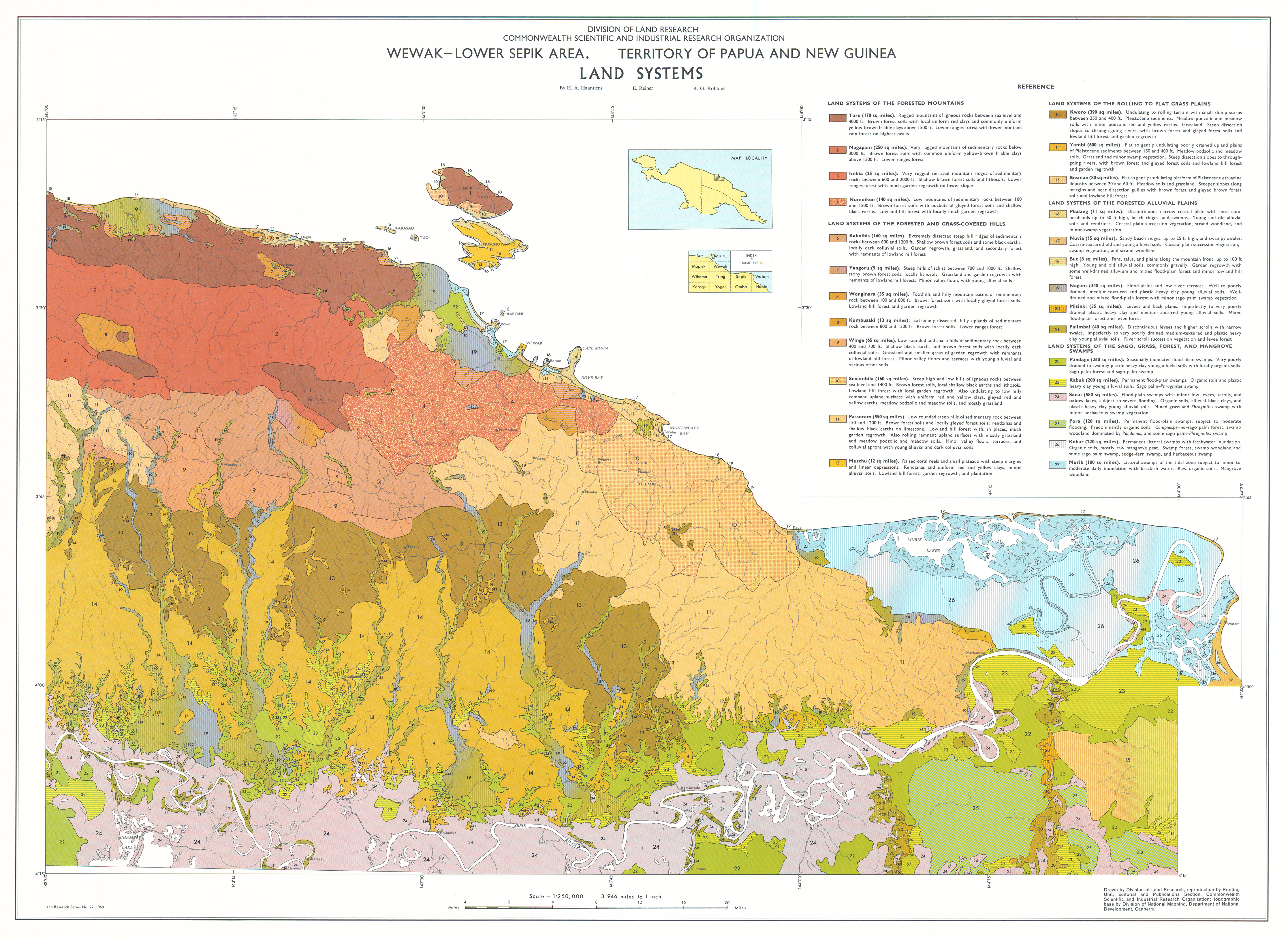
The survey identified 27 land systems ranging from 21 km2 to 1,550 km2 mainly distinguished by their altitude range, relief and vegetation with between two and seven land units in 23 of the land systems. Separate units were not described for the other four systems.
The report provides a general description for the geology, physical features, population and land use and an agricultural assessment of each land system. The area and distribution, landform, soil and drainage status, and vegetation are recorded for each of the 82 identified land units and, for 22 of the 27 land systems, their position in the landscape is shown on block diagrams.
Individual disciplinary chapters describe:
- Climate — general features and water availability for plant growth
- Geomorphology — six physical regions, geological and landscape history, and geomorphology of the land systems
- Pedology — soil classification and the profile characteristics of 55 soil families in 16 major groups, with selected chemical and physical properties, and details of formation and distribution of four soil sequences
- Vegetation — characteristics and ecology of five major vegetation types and 29 communities
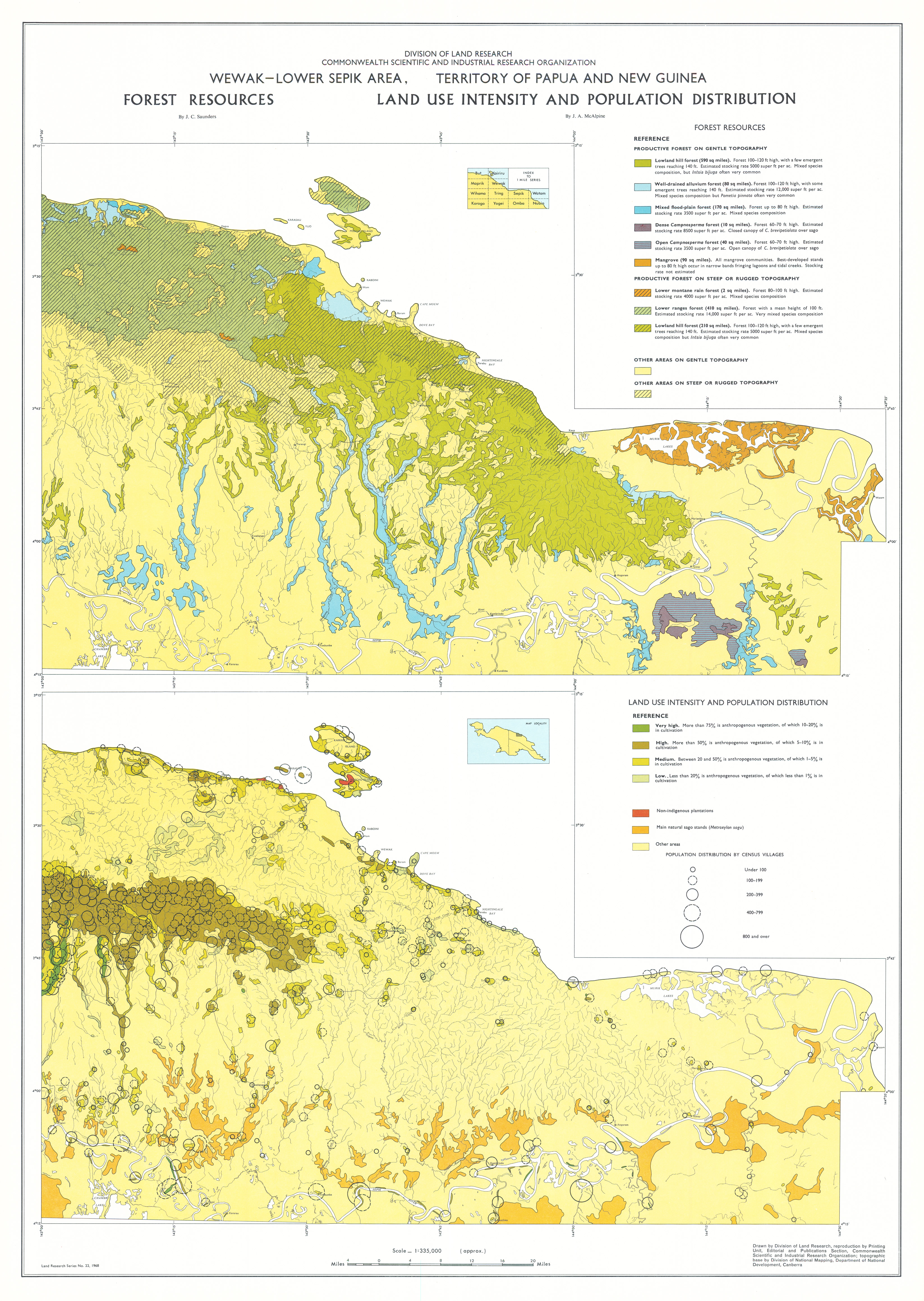
- Forest Resources — details of nine forest types with information on frequency of occurrence of significant tree species in each type
- Population, Land Use and Transport — distribution and density of population and land use and relationships between population, land use and environment with notes on subsistence cultivation and sago, tree and other cash crops
- Land Use Capability — categories and their limiting factors and the estimated area of capability classes within each land system
Map 1 — Land Systems of the Wewak–Lower Sepik area, Territory of Papua and New Guinea by HA Haantjens, E Reiner and RG Robbins. Scale 1:250,000. CSIRO Land Research Series No 22, 1968.
Map 2 — Forest Resources, Land Use Intensity and Population Distribution of the Wewak–Lower Sepik area, Territory of Papua and New Guinea. Two maps on sheet, each approx. 1:335,000: Forest Resources by JC Saunders; Land Use Intensity and Population Distribution by JR McAlpine. CSIRO Land Research Series No 22, 1968.
Editor's Note: The population was 76,000 at the time of the survey and now exceeds 100,000.
https://doi.org/10.1071/LRS22
© CSIRO 2010