Register      Login
Wildlife Research Wildlife Research Society
Ecology, management and conservation in natural and modified habitats
Table of Contents
Wildlife Research

Wildlife Research

Volume 52 Number 9 2025


Photograph of a dingo resting on the beach.

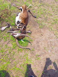
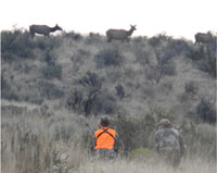
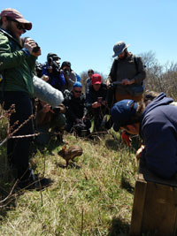
The effects of lethal management on carnivore populations are rarely measured. This study modelled how different levels of lethal management could impact a known dingo population in eastern Australia, and showed that lethal control targeting individual problem animals has less impact on population persistence than broadscale culls. In scenarios where this is possible, and where carnivore population persistence is desired, we recommend that targeted lethal control of individuals should take precedence over indiscriminate lethal management. Photograph by Alexander Dibnah.


Antilope hunting residues in southwestern Ethiopia.

As a result of rapid human population growth associated with rural poverty, wildlife conservation in Ethiopia is challenging. These challenges originate from resource-use conflicts, insufficient funding, political instabilities, and policy gaps. This perspective aimed to compile scientific evidence on wildlife conservation problems in Ethiopia focusing on ecotourism as a solution. Photograph by E. B. Tefera.

WR24160Flight heights in ibis and spoonbills: implications for collision risk

Batbayar Galtbalt, Heather M. McGinness 0000-0002-0380-4982, Shoshana Rapley, Micha V. Jackson, Luke R. Lloyd-Jones, Freya Robinson, Louis O’Neill, Melissa Piper, Micah Davies, John Martin, Richard Kingsford, Kate Brandis, Ralph Mac Nally, Marcel Klaassen, Art Langston, Jessica Hodgson and Veronica Doerr

A photograph of an adult royal spoonbill, Platalea regia.

Millions of birds worldwide have become victims of airspace collisions with aircraft and wind turbines. This study aimed to improve understanding of waterbird (ibis and spoonbill) flight characteristics by using GPS satellite telemetry data, as a first step in assessing species vulnerability to collision. There was clear overlap between flight heights and collision zones found, and we make recommendations for factors that should be considered when assessing spatially and temporally explicit scenarios of risk management. Photograph by Heather McGinness.

WR24203From mailbox to inbox: mail vs internet waterfowl hunter survey responses

Jerry J. Vaske 0000-0002-6703-2264, Eric M. Walberg 0000-0002-2076-3262, Brent D. Williams, Samantha G. Pallazza, Lauren J. Stephens and Craig A. Miller

Photograph of a flock of flying waterfowl.

Declining response rates from mail surveys have prompted a shift toward internet surveys, which has raised questions about results comparability. This study examined survey quality indicators by comparing mail and internet survey responses from waterfowl hunters in Illinois. The findings highlighted the potential of internet surveys as an alternative to mail surveys in human–wildlife research. Photograph by Ryan Askren.


A photo of hunters targeting elk as they travel to higher elevation areas through grasslands and sagebrush steppe

Many hunters are switching to copper bullets to reduce lead exposure in wildlife and game meat, but little is known about how these bullets perform at long range. In our study of elk shot with copper bullets, recovered animals were hit at an average of 305 m compared with 391 m for unrecovered animals, although overall recovery rates were 91%. These findings support copper bullets as an effective option for long-range hunting when used by skilled hunters. Photograph by Craig Jourdonnais.


Press event for the release of a founder New England cottontail on Nomans Land Island in Chilmark, Massachusetts.

Islands can play an important role in conserving small mammals. This study monitored the establishment of an island breeding colony by fitting the founding animals with global positioning system radio collars. The founding animals had high individual variability in the resources they selected, which demonstrates that nearly the entire island should be able to support a large breeding colony. Photograph by T.J. McGreevy.


A graphical presentation of human and livestock losses in the study area in western India.

This study in Marathwada, western India, delved into the nuanced dynamics of human–wildlife conflict, offering a robust foundation for evidence-based conservation management. By systematically analyzing extensive conflict data, the research identified critical hotspots, temporal trends, and key species driving conflicts, highlighting the disproportionate burden on farming communities. The findings emphasize the need for tailored, farmer-centric conflict mitigation strategies and underscore the importance of balancing conservation priorities with rural livelihoods, presenting a scalable framework for human–wildlife coexistence in similar landscapes globally. Image by Pandurang Pawar.

WR24188Using a state vegetation type map to predict legal koala habitat at large scale: a case study in the Mid North Coast region of NSW

Cristian Gabriel Orlando 0000-0003-3937-423X, Rebecca Montague-Drake, John Turbill, Allen McIlwee and Mathew S. Crowther 0000-0001-8968-1161

Female koala with her joey resting on her head, sitting on a tree branch.

In the face of continued koala habitat loss, large-scale mapping methods that accurately predict ‘legal’ koala habitat are essential for the species’ conservation. Our study tested a new vegetation-mapping approach, which slightly outperformed on-ground surveys in identifying potential koala habitats. This method provides wildlife managers, policy makers, and consultants with a reliable, scalable tool for land management and planning. Photograph by John Turbill.


Graph showing predicted greater sooty owl occupancy against Maxent-modelled habitat suitability for field survey sites.

Species distribution models (SDMs) are used for a variety of purposes, yet they are rarely validated externally to test the accuracy of habitat suitability predictions. Using the greater sooty owl as a case study, we demonstrated an approach to validating species distribution models. Our approach could be applied to a variety of species to test the accuracy of SDMs, and provides insight into environmental variables relevant to greater sooty owl conservation, while identifying areas of predicted high-quality habitat in south-eastern Queensland, which could be targeted for future surveys and habitat protection. Graph by Dylan Westaway.


A photo showing a section of Dog Fence built to exclude dingoes from sheep grazing land in South Australia.

The Dog Fence was built to exclude dingoes (Canis familiaris) from sheep (Ovis aries) grazing land. This study reviewed historic newspaper articles to examine dingo impacts on the South Australian sheep industry before the Dog Fence, as well as challenges and consequences of broad-scale dingo control. The articles highlighted the extensive damage and cost dingoes caused the sheep industry. However, widespread control led to unintended ecological consequences, including rapid increases in rabbit (Oryctolagus cuniculus) and native herbivore populations. Photograph by David Taggart.

Committee on Publication Ethics

Wildlife Research Submissions

Submit in the format of your choice with Format-Free Submission.

Call for Papers

We are seeking contributions for the following Special Issues, More information

Advertisement